Santa Barbara, California Weather
No Watches or Warnings for Santa Barbara
Issued: 3:46 am PDT Mar 31, 2025 Latitude: 34.4208305 Longitude: -119.6981901 View on Google Maps
|
|
|
|
|
|
|
|
|
|
 |
 |
 |
 |
 |
|
|
|
| Low: °F |
High: °F |
High: °F |
High: °F |
High: °F |
High: °F |
High: °F |
High: °F |
| Low: °F |
Low: °F |
Low: °F |
Low: °F |
Low: °F |
Low: °F |
|
| Rain |
Rain |
Partly Sunny |
Sunny |
Morning Fog |
Sunny |
Sunny |
Sunny |
Current Conditions at
SANTA BARBARA - (KSBA)
55°
Cloudy
Mist
as of 3:42 AM PDST
Rel. Humidity: 100%
Dew Point: 55°F
Visibility: 1 3/4 Miles
Pressure: 30.06 in.
Flight Rule: LIFR
Cloud Level(s): Solid Overcast at 400ft
Current Conditions at
OXNARD - (KOXR)
55°
Cloudy
Mist
as of 3:40 AM PDST
Rel. Humidity: 100%
Dew Point: 55°F
Visibility: 2 1/2 Miles
Pressure: 30.06 in.
Flight Rule: IFR
Wind Data
8 MPH
060° Northeast
Cloud Level(s): Solid Overcast at 600ft
Current Conditions at
CAMARILLO - (KCMA)
57°
Cloudy
as of 2:55 AM PDST
Rel. Humidity: 87%
Dew Point: 54°F
Visibility: 9 Miles
Pressure: 30.07 in.
Flight Rule: MVFR
Wind Data
7 MPH
050° Northeast
Cloud Level(s): Solid Overcast at 1300ft
Current Conditions at
POINT MUGU NAS - (KNTD)
57°
Cloudy
Light Rain Mist
as of 2:55 AM PDST
Rel. Humidity: 87%
Dew Point: 54°F
Visibility: 2 Miles
Pressure: 30.07 in.
Flight Rule: IFR
Cloud Level(s): Few at 400ft, Solid Overcast at 900ft
|
Overnight... Rain likely. Mostly cloudy, with a low around 51. East southeast wind around 5 mph. Chance of precipitation is 60%. New precipitation amounts of less than a tenth of an inch possible. |
|
|
Monday... Rain likely before 11am. Partly sunny, with a high near 64. East wind 5 to 10 mph becoming west southwest 10 to 15 mph in the afternoon. Chance of precipitation is 60%. New precipitation amounts of less than a tenth of an inch possible. |
|
 |
Monday Night... Partly cloudy, with a low around 47. West northwest wind around 15 mph, with gusts as high as 20 mph. |
|
|
Tuesday... Partly sunny, with a high near 62. Breezy, with a west northwest wind 15 to 20 mph, with gusts as high as 25 mph. |
|
|
Tuesday Night... Partly cloudy, with a low around 44. Breezy, with a west northwest wind 15 to 20 mph, with gusts as high as 25 mph. |
|
|
Wednesday... Sunny, with a high near 63. |
|
 |
Wednesday Night... Patchy fog after 11pm. Otherwise, mostly cloudy, with a low around 43. |
|
|
Thursday... Patchy fog before 11am. Otherwise, partly sunny, with a high near 60. |
|
 |
Thursday Night... Mostly clear, with a low around 44. |
|
|
Friday... Sunny, with a high near 69. |
|
|
Friday Night... Mostly clear, with a low around 47. |
|
|
Saturday... Sunny, with a high near 71. |
|
|
Saturday Night... Mostly clear, with a low around 49. |
|
|
Sunday... Sunny, with a high near 71. |
|
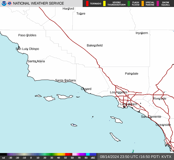
Current Radar Image
Sun Almanac for Santa Barbara, California
Sunrise: 06:46 AM
Sunset: 7:19 PM
Civil Sunrise:06:21 AM
Civil Sunset: 7:44 PM
Nautical Sunrise: 05:51 AM
Nautical Sunset: 8:14 PM
Astro Sunrise: 05:21 AM
Astro Sunset: 8:45 PM
California's Current Temperatures
 California's Satellite Image
 California's Current Wind Direction
| National Summary |
of upper and lower values of current conditions amongst 7060 locations
in the contiguous United States |
|
High
Temp |
79° |
Key West NAS, Florida
and 2 other locations
|
|
Low
Temp |
10° |
Cando Municipal A/P, North Dakota
|
|
Wind
Speed |
36mph |
New Roads, Louisiana
|
|
Wind
Gust |
44mph |
New Roads, Louisiana
|
|
Wind
Chill |
0° |
Salida Mountain, Colorado
|
|
High
Pressure |
30.17Hg |
Harvey Municipal A/P, North Dakota
and 3 other locations
|
|
Low
Pressure |
29.45Hg |
Watertown, New York
and 2 other locations
|
|
| # Locations Reporting Snow |
21 |
|
| # Locations Reporting Rain |
136 |
|
| # Locations Reporting Thunderstorms / Lightning |
15 |
|
| # Locations Reporting Fog |
38 |
|
| Average Temperature in the Contiguous USA |
48° |
|
Any use of the information on this page is at your own risk. This information should not be relied upon in life-threatening situations, potential financial loss situations or in lieu of any officially disseminated information. Visit the
National Weather Service for official information.