Tottenville, New York Weather
Issued: 5:36 am EST Feb 5, 2025 Latitude: 40.5112167 Longitude: -74.2493117 View on Google Maps
|
|
|
|
|
|
|
|
|
|
 |
 |
 |
 |
 |
 |
|
 |
| High: °F |
Low: °F |
High: °F |
High: °F |
High: °F |
High: °F |
High: °F |
High: °F |
| Low: °F |
Low: °F |
Low: °F |
Low: °F |
Low: °F |
|
| Mostly Cloudy |
Snow & Sleet |
Freezing Rain & Snow |
Mostly Sunny |
Snow |
Rain |
Mostly Sunny |
Rain & Snow |
Current Conditions at
NEWARK - (KEWR)
Mostly Cloudy
as of 5:51 AM EST
Rel. Humidity: 42%
Dew Point: 9°F
Visibility: 10 Miles
Pressure: 30.36 in.
Flight Rule: VFR
Wind Data
9 MPH
Gust: 25 MPH
340° North
Cloud Level(s): Few at 4500ft, Broken at 12000ft, Broken at 25000ft
Current Conditions at
MORRISTOWN - (KMMU)
27°
Cloudy
as of 6:35 AM EST
Rel. Humidity: 45%
Dew Point: 9°F
Visibility: 10 Miles
Pressure: 30.36 in.
Flight Rule: VFR
Wind Data
8 MPH
310° Northwest
Cloud Level(s): Solid Overcast at 12000ft
Current Conditions at
SOMERSET - (KSMQ)
28°
Clear
as of 5:53 AM EST
Rel. Humidity: 50%
Dew Point: 12°F
Visibility: 10 Miles
Pressure: 30.35 in.
Flight Rule: VFR
Wind Data
7 MPH
330° Northwest
Cloud Level(s): Clear
Current Conditions at
CENTRAL PARK NYC - (KNYC)
27°
Cloudy
as of 5:51 AM EST
Rel. Humidity: 45%
Dew Point: 9°F
Visibility: 10 Miles
Pressure: 30.36 in.
Flight Rule: VFR
Cloud Level(s): Solid Overcast at 12000ft
|
Today... Mostly cloudy, with a high near 36. Wind chill values between 20 and 30. North wind 5 to 7 mph becoming calm in the afternoon. |
|
|
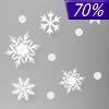
Tonight... A chance of snow between 10pm and 4am, then snow and sleet likely. Cloudy, with a low around 29. Calm wind becoming southeast around 6 mph after midnight. Chance of precipitation is 70%. New snow and sleet accumulation of less than one inch possible. |
|
|
Thursday... Snow, freezing rain, and sleet before 10am, then rain. High near 40. Wind chill values between 20 and 30. Southeast wind 5 to 14 mph becoming west in the afternoon. Chance of precipitation is 100%. Little or no ice accumulation expected. New snow and sleet accumulation of less than a half inch possible. |
|
 |
Thursday Night... Mostly cloudy, with a low around 36. Southwest wind 6 to 9 mph, with gusts as high as 20 mph. |
|
|
Friday... Mostly sunny, with a high near 44. West wind 11 to 14 mph, with gusts as high as 32 mph. |
|
 |
Friday Night... Partly cloudy, with a low around 24. |
|
|
Saturday... A 50 percent chance of snow after 1pm. Mostly cloudy, with a high near 38. |
|
 |
Saturday Night... Rain, possibly mixed with snow and freezing rain before midnight, then rain and snow. Low around 30. Chance of precipitation is 90%. |
|
|
Sunday... A 30 percent chance of rain before 1pm. Partly sunny, with a high near 46. |
|
|
Sunday Night... Partly cloudy, with a low around 25. |
|
|
Monday... Mostly sunny, with a high near 38. |
|
|
Monday Night... Mostly cloudy, with a low around 23. |
|
|
Tuesday... A chance of rain and snow. Mostly cloudy, with a high near 36. Chance of precipitation is 40%. |
|
Current Radar Image
Sun Almanac for Tottenville, New York
Sunrise: 07:02 AM
Sunset: 5:20 PM
Civil Sunrise:06:33 AM
Civil Sunset: 5:49 PM
Nautical Sunrise: 06:01 AM
Nautical Sunset: 6:21 PM
Astro Sunrise: 05:29 AM
Astro Sunset: 6:53 PM
New York's Current Temperatures
 New York's Satellite Image
 New York's Current Wind Direction
| National Summary |
of upper and lower values of current conditions amongst 7053 locations
in the contiguous United States |
|
High
Temp |
77° |
Keathley C 875, Louisiana
|
|
Low
Temp |
-15° |
Watertown, New York
and 1 other location
|
|
Wind
Speed |
44mph |
Evanston, Wyoming
|
|
Wind
Gust |
61mph |
Evanston, Wyoming
|
|
Wind
Chill |
-23° |
Frenchville, Maine
|
|
High
Pressure |
30.49Hg |
Menominee, Michigan
|
|
Low
Pressure |
29.33Hg |
Salmon, Idaho
|
|
| # Locations Reporting Snow |
58 |
|
| # Locations Reporting Rain |
34 |
|
| # Locations Reporting Fog |
100 |
|
| Average Temperature in the Contiguous USA |
33° |
|
Any use of the information on this page is at your own risk. This information should not be relied upon in life-threatening situations, potential financial loss situations or in lieu of any officially disseminated information. Visit the
National Weather Service for official information.


