Sign Post, Virginia Weather
No Watches or Warnings for Sign Post
|
|
|
|
|
|
|
|
 |
 |
 |
 |
 |
|
 |
 |
| High: °F |
Low: °F |
High: °F |
High: °F |
High: °F |
High: °F |
High: °F |
High: °F |
| Low: °F |
Low: °F |
Low: °F |
Low: °F |
Low: °F |
|
| Rain & Sleet |
Rain & Sleet |
Rain |
Mostly Sunny |
Rain & Snow |
Mostly Sunny |
Snow |
Rain & Snow |
Current Conditions at
WALLOPS ISLAND - (KWAL)
37°
Cloudy
as of 8:54 AM EST
Rel. Humidity: 51%
Dew Point: 21°F
Visibility: 10 Miles
Pressure: 30.41 in.
Flight Rule: VFR
Cloud Level(s): Solid Overcast at 6500ft
Current Conditions at
SALISBURY - (KSBY)
34°
Cloudy
as of 8:54 AM EST
Rel. Humidity: 59%
Dew Point: 21°F
Visibility: 10 Miles
Pressure: 30.42 in.
Flight Rule: VFR
Cloud Level(s): Solid Overcast at 7500ft
Current Conditions at
OCEAN CITY - (KOXB)
36°
Cloudy
as of 8:53 AM EST
Rel. Humidity: 59%
Dew Point: 23°F
Visibility: 10 Miles
Pressure: 30.41 in.
Flight Rule: VFR
Cloud Level(s): Solid Overcast at 8000ft
Current Conditions at
ST INIGOES/WEBSTER - (KNUI)
37°
Cloudy
as of 8:53 AM EST
Rel. Humidity: 64%
Dew Point: 27°F
Visibility: 10 Miles
Pressure: 30.41 in.
Flight Rule: VFR
Cloud Level(s): Solid Overcast at 6000ft
|
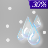
Today... A chance of rain after 1pm, mixing with sleet after 2pm. Cloudy, with a high near 37. East wind around 8 mph. Chance of precipitation is 30%. Little or no sleet accumulation expected. |
|
|
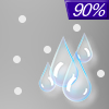
Tonight... A chance of rain and sleet before 8pm, then rain. Low around 34. East wind 7 to 9 mph. Chance of precipitation is 90%. Little or no sleet accumulation expected. |
|
|
Thursday... Rain, mainly before 1pm, then a chance of showers after 1pm. High near 52. Southeast wind 7 to 15 mph becoming southwest in the afternoon. Winds could gust as high as 23 mph. Chance of precipitation is 90%. New precipitation amounts between a tenth and quarter of an inch possible. |
|
 |
Thursday Night... A chance of showers, mainly before 1am. Mostly cloudy, with a low around 45. Southwest wind 8 to 13 mph. Chance of precipitation is 30%. New precipitation amounts of less than a tenth of an inch possible. |
|
|
Friday... Mostly sunny, with a high near 55. Northwest wind 8 to 13 mph. |
|
 |
Friday Night... Partly cloudy, with a low around 29. |
|
|
Saturday... A chance of snow before 1pm, then a chance of rain. Mostly cloudy, with a high near 40. Chance of precipitation is 50%. |
|
 |
Saturday Night... Rain likely, mainly before 1am. Mostly cloudy, with a low around 38. Chance of precipitation is 70%. |
|
|
Sunday... Cloudy, then gradually becoming mostly sunny, with a high near 59. |
|
|
Sunday Night... A chance of snow after 1am. Mostly cloudy, with a low around 30. Chance of precipitation is 30%. |
|
|
Monday... A chance of snow. Partly sunny, with a high near 42. Chance of precipitation is 30%. |
|
 |
Monday Night... A chance of rain and snow. Mostly cloudy, with a low around 31. Chance of precipitation is 40%. |
|
|
Tuesday... Rain and snow likely. Mostly cloudy, with a high near 42. Chance of precipitation is 70%. |
|
Current Radar Image
Sun Almanac for Sign Post, Virginia
Sunrise: 07:02 AM
Sunset: 5:30 PM
Civil Sunrise:06:35 AM
Civil Sunset: 5:57 PM
Nautical Sunrise: 06:03 AM
Nautical Sunset: 6:28 PM
Astro Sunrise: 05:33 AM
Astro Sunset: 6:59 PM
Virginia's Current Temperatures
 Virginia's Satellite Image
 Virginia's Current Wind Direction
| National Summary |
of upper and lower values of current conditions amongst 7125 locations
in the contiguous United States |
|
High
Temp |
79° |
Keathley C 875, Louisiana
|
|
Low
Temp |
-13° |
Foxtrot, Montana
|
|
Wind
Speed |
33mph |
Elk Mountain, Wyoming
|
|
Wind
Gust |
47mph |
Salmon, Idaho
|
|
Wind
Chill |
-28° |
Helena, Montana
|
|
High
Pressure |
30.51Hg |
Massena, New York
|
|
Low
Pressure |
29.48Hg |
Mullan Pass, Idaho
and 1 other location
|
|
| # Locations Reporting Snow |
59 |
|
| # Locations Reporting Rain |
39 |
|
| # Locations Reporting Fog |
74 |
|
| Average Temperature in the Contiguous USA |
35° |
|
Any use of the information on this page is at your own risk. This information should not be relied upon in life-threatening situations, potential financial loss situations or in lieu of any officially disseminated information. Visit the
National Weather Service for official information.


