| your sport, your way | ||||
 |  |  |  |  |
|

| Today | Tonight | Thursday | Friday | Saturday | Sunday | Monday | Tuesday |
 |
 |
 |
 |
|
 |
|
|
| High: 17°F | Low: 10°F | High: 35°F | High: 28°F | High: 26°F | High: 29°F | High: 26°F | High: 24°F |
| Low: 21°F | Low: 16°F | Low: 19°F | Low: 11°F | Low: 11°F | |||
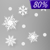
| Mostly Sunny | Snow | Freezing Rain & Snow | Snow | Snow | Snow | Snow | Snow |


|
Today... Mostly sunny, with a high near 17. Calm wind becoming west 5 to 8 mph in the morning. |
|
Tonight... A chance of snow after 5am. Mostly cloudy, with a low around 10. Calm wind becoming southeast 5 to 9 mph after midnight. Chance of precipitation is 30%. Little or no snow accumulation expected. |
|
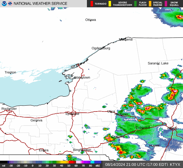
Thursday... Snow and sleet before 4pm, then sleet likely, possibly mixed with freezing rain between 4pm and 5pm, then a chance of snow, freezing rain, and sleet after 5pm. High near 35. Southeast wind 9 to 16 mph. Chance of precipitation is 90%. Little or no ice accumulation expected. New snow and sleet accumulation of 1 to 3 inches possible. |
 |
Thursday Night... A chance of snow showers and sleet before 7pm, then snow showers. Low around 21. West wind 11 to 18 mph, with gusts as high as 30 mph. Chance of precipitation is 80%. New snow and sleet accumulation of 1 to 2 inches possible. |
|
Friday... Snow showers, mainly before 7am. High near 28. West wind 15 to 18 mph, with gusts as high as 31 mph. Chance of precipitation is 80%. |
 |
Friday Night... A chance of snow showers. Mostly cloudy, with a low around 16. West wind 6 to 13 mph. Chance of precipitation is 50%. |
|
Saturday... A chance of snow showers before 1pm. Mostly cloudy, with a high near 26. Calm wind becoming south around 5 mph in the afternoon. Chance of precipitation is 30%. |
 |
Saturday Night... Snow. Low around 19. East wind 6 to 8 mph becoming south after midnight. Chance of precipitation is 100%. |
|
Sunday... Snow showers likely, mainly before 1pm. Mostly cloudy, with a high near 29. Chance of precipitation is 60%. |
|
Sunday Night... A chance of snow showers. Mostly cloudy, with a low around 11. Chance of precipitation is 50%. |
|
Monday... A chance of snow showers. Mostly cloudy, with a high near 26. Chance of precipitation is 30%. |
 |
Monday Night... Mostly cloudy, with a low around 11. |
|
Tuesday... A chance of snow showers. Mostly cloudy, with a high near 24. Chance of precipitation is 30%. |