
| your sport, your way | ||||
 |  |  |  |  |
|

| Overnight | Wednesday | Thursday | Friday | Saturday | Sunday | Monday | Tuesday |
 |
 |
 |
 |
 |
 |
|
 |
| Low: 24°F | High: 34°F | High: 43°F | High: 35°F | High: 35°F | High: 31°F | High: 34°F | High: 27°F |
| Low: 30°F | Low: 22°F | Low: 27°F | Low: 18°F | Low: 16°F | Low: 18°F | ||
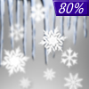
| Mostly Cloudy | Freezing Rain | Mostly Cloudy | Partly Sunny | Freezing Rain & Snow | Mostly Sunny | Mostly Sunny | Snow |


|
Overnight... Mostly cloudy, with a low around 24. East wind around 15 mph. |
|
Wednesday... A chance of freezing rain before 2pm, then rain between 2pm and 5pm, then freezing rain after 5pm. High near 34. East wind around 10 mph, with gusts as high as 20 mph. Chance of precipitation is 80%. Little or no ice accumulation expected. |
|
Wednesday Night... Freezing rain before 9pm, then rain between 9pm and midnight. Low around 30. Southeast wind 5 to 10 mph becoming west after midnight. Winds could gust as high as 20 mph. Chance of precipitation is 80%. Little or no ice accumulation expected. |
|
Thursday... Mostly cloudy, then gradually becoming sunny, with a high near 43. Northwest wind 10 to 15 mph, with gusts as high as 25 mph. |
 |
Thursday Night... Partly cloudy, with a low around 22. |
|
Friday... Partly sunny, with a high near 35. |
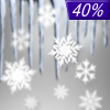 |
Friday Night... A chance of snow and freezing rain after midnight. Mostly cloudy, with a low around 27. Chance of precipitation is 40%. |
|
Saturday... Rain or freezing rain before noon, then a chance of rain and snow. High near 35. Chance of precipitation is 80%. |
|
Saturday Night... Mostly cloudy, with a low around 18. |
|
Sunday... Mostly sunny, with a high near 31. |
|
Sunday Night... Partly cloudy, with a low around 16. |
|
Monday... Mostly sunny, with a high near 34. |
|
Monday Night... Mostly cloudy, with a low around 18. |
|
Tuesday... A 30 percent chance of snow. Partly sunny, with a high near 27. |


