Naples, Illinois Weather
your sport, your way
Air Sports Net on FacebookAir Sports Net on Google +Air Sports Net on TwitterReceive RSS UpdatesReceive Email Updates

Change location by the zip code or city,state: or search for other weather forecast locations in Illinois by name.
Weather Forecast for Naples, Illinois : Scott County
Issued: 12:42 am CST Feb 5, 2025 Latitude: 39.7572686 Longitude: -90.6073489 View on Google Maps

MouseOver for Detail Forecast
Overnight Wednesday Thursday Friday Saturday Sunday Monday Tuesday
20% chance of freezing rain on Overnight 80% chance of freezing rain on Wednesday Mostly Cloudy on Thursday Increasing Clouds on Friday 70% chance of rain on Saturday Mostly Sunny on Sunday Mostly Sunny on Monday 20% chance of snow on Tuesday
Low: 28°F High: 35°F High: 47°F High: 38°F High: 41°F High: 36°F High: 37°F High: 31°F
Low: 35°F Low: 27°F Low: 32°F Low: 23°F Low: 21°F Low: 23°F  
Freezing Rain Freezing Rain Mostly Cloudy Increasing Clouds Rain Mostly Sunny Mostly Sunny Snow
-
Current Conditions at
PITTSFIELD - (KPPQ)
30°
Feels like 20°F
Cloudy
as of 12:35 AM CST
Rel. Humidity: 74%
Dew Point: 23°F
Visibility: 10 Miles
Pressure: 30.34 in.
Flight Rule: VFR
Wind Data
12 MPH
050° Northeast
Cloud Level(s): Solid Overcast at 3100ft
Current Conditions at
JACKSONVILLE MUNICIPAL - (KIJX)
28°
Feels like 17°F
Cloudy
as of 12:35 AM CST
Rel. Humidity: 74%
Dew Point: 21°F
Visibility: 10 Miles
Pressure: 30.36 in.
Flight Rule: VFR
Wind Data
15 MPH
060° Northeast
Cloud Level(s): Scattered at 1600ft, Solid Overcast at 3400ft
Current Conditions at
QUINCY - (KUIN)
30°
Feels like 20°F
Cloudy
as of 11:54 PM CST
Rel. Humidity: 68%
Dew Point: 21°F
Visibility: 10 Miles
Pressure: 30.33 in.
Flight Rule: VFR
Wind Data
13 MPH
070° East
Cloud Level(s): Solid Overcast at 3600ft
Current Conditions at
SPRINGFIELD - (KSPI)
28°
Feels like 17°F
Cloudy
as of 11:52 PM CST
Rel. Humidity: 74%
Dew Point: 21°F
Visibility: 10 Miles
Pressure: 30.37 in.
Flight Rule: VFR
Wind Data
14 MPH
050° Northeast
Cloud Level(s): Few at 1700ft, Solid Overcast at 4100ft
20% chance of freezing rain Overnight 
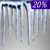
Overnight... A slight chance of freezing rain after 5am. Cloudy, with a low around 28. East northeast wind around 9 mph, with gusts as high as 17 mph. Chance of precipitation is 20%.

80% chance of freezing rain Wednesday Wednesday... A chance of freezing rain before 11am, then rain. High near 35. East northeast wind 7 to 9 mph, with gusts as high as 17 mph. Chance of precipitation is 80%. Little or no ice accumulation expected.

80% chance of thunderstorms Wednesday Night Wednesday Night... Rain and possibly a thunderstorm before 9pm, then a chance of rain between 9pm and midnight. Low around 35. East southeast wind 5 to 7 mph becoming west after midnight. Winds could gust as high as 15 mph. Chance of precipitation is 80%. New precipitation amounts of less than a tenth of an inch, except higher amounts possible in thunderstorms.

Mostly Cloudy on Thursday Thursday... Mostly cloudy, then gradually becoming sunny, with a high near 47. West wind 7 to 10 mph, with gusts as high as 17 mph.

Mostly Clear on Thursday Night Thursday Night... Mostly clear, with a low around 27. West northwest wind around 5 mph becoming light and variable in the evening.

Increasing Clouds on Friday Friday... Increasing clouds, with a high near 38. East wind 3 to 6 mph.

60% chance of rain & snow Friday Night Friday Night... A chance of rain and snow before midnight, then rain likely. Cloudy, with a low around 32. East wind 6 to 9 mph, with gusts as high as 17 mph. Chance of precipitation is 60%. New precipitation amounts of less than a tenth of an inch possible.

70% chance of rain Saturday Saturday... Rain likely, mainly before noon. Mostly cloudy, with a high near 41. Chance of precipitation is 70%.

Mostly Cloudy on Saturday Night Saturday Night... Mostly cloudy, with a low around 23.

Mostly Sunny on Sunday Sunday... Mostly sunny, with a high near 36.

Mostly Clear on Sunday Night Sunday Night... Mostly clear, with a low around 21.

Mostly Sunny on Monday Monday... Mostly sunny, with a high near 37.

Mostly Cloudy on Monday Night Monday Night... Mostly cloudy, with a low around 23.

20% chance of snow Tuesday Tuesday... A chance of snow. Mostly cloudy, with a high near 31.

Current Radar Image


Sun Almanac for Naples, Illinois
Sunrise: 07:06 AM
Sunset: 5:27 PM
Civil Sunrise:06:38 AM
Civil Sunset: 5:55 PM
Nautical Sunrise: 06:06 AM
Nautical Sunset: 6:27 PM
Astro Sunrise: 05:34 AM
Astro Sunset: 6:59 PM
Any use of the information on this page is at your own risk. This information should not be relied upon in life-threatening situations, potential financial loss situations or in lieu of any officially disseminated information. Visit the National Weather Service for official information.