Lake Arthur, New Mexico Weather
Issued: 12:02 am MDT Mar 14, 2025 Latitude: 32.9981657 Longitude: -104.3666291 View on Google Maps
|
|
|
|
|
|
|
|
|
|
 |
|
 |
 |
 |
|
|
|
| Low: °F |
High: °F |
High: °F |
High: °F |
High: °F |
High: °F |
High: °F |
High: °F |
| Low: °F |
Low: °F |
Low: °F |
Low: °F |
Low: °F |
Low: °F |
|
| Dust |
Dust |
Rain |
Sunny |
Mostly Sunny |
Dust |
Sunny |
Sunny |
Current Conditions at
ARTESIA - (KATS)
64°
Cloudy
Haze
as of 11:55 PM MDST
Rel. Humidity: 16%
Dew Point: 18°F
Visibility: 3 Miles
Pressure: 29.62 in.
Flight Rule: LIFR
Wind Data
22 MPH
Gust: 32 MPH
220° Southwest
Cloud Level(s): Broken at 100ft, Solid Overcast at 1100ft
Current Conditions at
ROSWELL - (KROW)
64°
Cloudy
Haze
as of 11:51 PM MDST
Rel. Humidity: 18%
Dew Point: 21°F
Visibility: 4 Miles
Pressure: 29.55 in.
Flight Rule: MVFR
Wind Data
18 MPH
Gust: 29 MPH
210° Southwest
Cloud Level(s): Solid Overcast at 3700ft
Current Conditions at
CARLSBAD - (KCNM)
61°
Mostly Cloudy
Haze
as of 11:53 PM MDST
Rel. Humidity: 17%
Dew Point: 16°F
Visibility: 5 Miles
Pressure: 29.63 in.
Flight Rule: MVFR
Wind Data
14 MPH
210° Southwest
Cloud Level(s): Broken at 3000ft
Current Conditions at
HOBBS - (KHOB)
57°
Cloudy
as of 11:55 PM MDST
Rel. Humidity: 16%
Dew Point: 12°F
Visibility: 10 Miles
Pressure: 29.63 in.
Flight Rule: MVFR
Wind Data
15 MPH
190° South
Cloud Level(s): Solid Overcast at 2500ft
|
Overnight... Widespread blowing dust. Mostly clear, with a low around 43. Windy, with a southwest wind 35 to 45 mph, with gusts as high as 65 mph. |
|
|
Friday... Widespread blowing dust, mainly before 5pm. Mostly sunny, with a high near 64. Windy, with a west wind 40 to 45 mph decreasing to 30 to 35 mph in the afternoon. Winds could gust as high as 60 mph. |
|
|
Friday Night... Areas of blowing dust before 10pm. Mostly cloudy, with a low around 35. Windy, with a west wind 25 to 30 mph decreasing to 15 to 20 mph after midnight. Winds could gust as high as 40 mph. |
|
|
Saturday... A 20 percent chance of showers after noon. Mostly sunny, with a high near 62. Breezy, with a northwest wind 15 to 20 mph increasing to 20 to 25 mph in the afternoon. Winds could gust as high as 35 mph. |
|
 |
Saturday Night... Mostly clear, with a low around 35. Breezy, with a west wind 20 to 25 mph decreasing to 10 to 15 mph after midnight. Winds could gust as high as 35 mph. |
|
|
Sunday... Sunny, with a high near 71. |
|
|
Sunday Night... Mostly clear, with a low around 37. |
|
|
Monday... Mostly sunny, with a high near 84. |
|
 |
Monday Night... Partly cloudy, with a low around 48. |
|
|
Tuesday... Areas of blowing dust after 11am. Mostly sunny, with a high near 81. Windy. |
|
|
Tuesday Night... Areas of blowing dust. Mostly clear, with a low around 39. Windy. |
|
|
Wednesday... Sunny, with a high near 65. |
|
|
Wednesday Night... Mostly clear, with a low around 31. |
|
|
Thursday... Sunny, with a high near 70. |
|
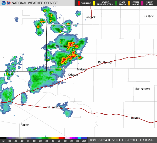
Current Radar Image
Sun Almanac for Lake Arthur, New Mexico
Sunrise: 07:08 AM
Sunset: 7:05 PM
Civil Sunrise:06:44 AM
Civil Sunset: 7:29 PM
Nautical Sunrise: 06:15 AM
Nautical Sunset: 7:58 PM
Astro Sunrise: 05:46 AM
Astro Sunset: 8:27 PM
New Mexico's Current Temperatures
 New Mexico's Satellite Image
 New Mexico's Current Wind Direction
| National Summary |
of upper and lower values of current conditions amongst 6309 locations
in the contiguous United States |
|
High
Temp |
81° |
Cotulla, Texas
and 2 other locations
|
|
Low
Temp |
18° |
Stanley Ranger Stn, Idaho
|
|
Wind
Speed |
35mph |
Belen, New Mexico
and 1 other location
|
|
Wind
Gust |
53mph |
Deming, New Mexico
|
|
Wind
Chill |
4° |
Pagosa Springs, Colorado
|
|
High
Pressure |
30.22Hg |
Rockland, Maine
and 2 other locations
|
|
Low
Pressure |
29.19Hg |
Mobridge, South Dakota
and 2 other locations
|
|
| # Locations Reporting Snow |
36 |
|
| # Locations Reporting Rain |
13 |
|
| # Locations Reporting Thunderstorms / Lightning |
2 |
|
| # Locations Reporting Fog |
9 |
|
| Average Temperature in the Contiguous USA |
50° |
|
Any use of the information on this page is at your own risk. This information should not be relied upon in life-threatening situations, potential financial loss situations or in lieu of any officially disseminated information. Visit the
National Weather Service for official information.