Grigg, Illinois Weather
your sport, your way
Air Sports Net on FacebookAir Sports Net on Google +Air Sports Net on TwitterReceive RSS UpdatesReceive Email Updates

Change location by the zip code or city,state: or search for other weather forecast locations in Illinois by name.
Weather Forecast for Grigg, Illinois : Randolph County
Issued: 3:06 am CST Feb 10, 2025 Latitude: 38.1906056 Longitude: -89.9078827 View on Google Maps

MouseOver for Detail Forecast
Today Tonight Tuesday Wednesday Thursday Friday Saturday Sunday
Partly Sunny on Today 50% chance of snow on Tonight 70% chance of snow on Tuesday 90% chance of freezing rain on Wednesday Partly Sunny on Thursday Partly Sunny on Friday 80% chance of rain on Saturday 20% chance of snow on Sunday
High: 41°F Low: 31°F High: 35°F High: 32°F High: 30°F High: 39°F High: 47°F High: 30°F
Low: 30°F Low: 21°F Low: 16°F Low: 33°F Low: 23°F  
Partly Sunny Snow Snow Freezing Rain Partly Sunny Partly Sunny Rain Snow
-
Current Conditions at
SPARTA - (KSAR)
27°
Clear
as of 3:55 AM CST
Rel. Humidity: 86%
Dew Point: 23°F
Visibility: 10 Miles
Pressure: 30.51 in.
Flight Rule: VFR
Wind Data
3 MPH
340° North
Cloud Level(s): Clear
Current Conditions at
SCOTT AFB - (KBLV)
23°
Clear
as of 3:55 AM CST
Rel. Humidity: 79%
Dew Point: 18°F
Visibility: 10 Miles
Pressure: 30.51 in.
Flight Rule: VFR
Wind Data
Calm
Cloud Level(s): Clear
Current Conditions at
FARMINGTON ARPT - (KFAM)
25°
Clear
as of 3:56 AM CST
Rel. Humidity: 79%
Dew Point: 19°F
Visibility: 10 Miles
Pressure: 30.48 in.
Flight Rule: VFR
Wind Data
6 MPH
350° North
Cloud Level(s): Clear
Partly Sunny on Today Today... Partly sunny, with a high near 41. East wind 3 to 8 mph.

50% chance of snow Tonight 
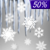
Tonight... A 50 percent chance of snow, mainly after 2am. Cloudy, with a low around 31. East wind around 6 mph.

70% chance of snow Tuesday Tuesday... Snow likely, mainly between 7am and 4pm. Cloudy, with a high near 35. Northeast wind 6 to 10 mph. Chance of precipitation is 70%. New snow accumulation of less than a half inch possible.

30% chance of snow & sleet Tuesday Night Tuesday Night... A chance of snow before 3am, then a slight chance of sleet. Cloudy, with a low around 30. Northeast wind around 8 mph. Chance of precipitation is 30%.

90% chance of freezing rain Wednesday Wednesday... Freezing rain, possibly mixed with sleet. High near 32. Northeast wind around 7 mph. Chance of precipitation is 90%. New ice accumulation of around a 0.1 of an inch possible. New sleet accumulation of less than a half inch possible.

50% chance of freezing rain & snow Wednesday Night Wednesday Night... A chance of freezing rain and sleet before 9pm, then a chance of snow between 9pm and midnight. Cloudy, with a low around 21. Chance of precipitation is 50%.

Partly Sunny on Thursday Thursday... Partly sunny, with a high near 30.

Cloudy on Thursday Night Thursday Night... Partly cloudy, with a low around 16.

Partly Sunny on Friday Friday... Partly sunny, with a high near 39.

50% chance of rain Friday Night Friday Night... A 50 percent chance of rain, mainly after midnight. Cloudy, with a low around 33.

80% chance of rain Saturday Saturday... Rain. High near 47. Chance of precipitation is 80%.

60% chance of rain & snow Saturday Night Saturday Night... Rain and snow likely. Cloudy, with a low around 23. Chance of precipitation is 60%.

20% chance of snow Sunday Sunday... A 20 percent chance of snow. Partly sunny, with a high near 30.

Current Radar Image


Sun Almanac for Grigg, Illinois
Sunrise: 06:55 AM
Sunset: 5:33 PM
Civil Sunrise:06:28 AM
Civil Sunset: 6:00 PM
Nautical Sunrise: 05:57 AM
Nautical Sunset: 6:31 PM
Astro Sunrise: 05:26 AM
Astro Sunset: 7:02 PM
Any use of the information on this page is at your own risk. This information should not be relied upon in life-threatening situations, potential financial loss situations or in lieu of any officially disseminated information. Visit the National Weather Service for official information.