| your sport, your way | ||||
 |  |  |  |  |
|

| Today | Tonight | Thursday | Friday | Saturday | Sunday | Monday | Tuesday |
 |
 |
 |
 |
 |
 |
|
|
| High: 17°F | Low: 4 °F | High: 32°F | High: 24°F | High: 25°F | High: 29°F | High: 24°F | High: 23°F |
| Low: 21°F | Low: 14°F | Low: 17°F | Low: 9°F | Low: 7°F | |||
| Partly Sunny | Mostly Cloudy | Freezing Rain & Snow | Snow | Mostly Cloudy | Snow | Mostly Cloudy | Mostly Cloudy |
|
Today... Partly sunny, with a high near 17. Wind chill values as low as -10. West wind 5 to 8 mph. |
|
Tonight... Mostly cloudy, with a low around 4. Wind chill values as low as -3. Calm wind becoming southeast 5 to 7 mph after midnight. |
|
Thursday... Snow, possibly mixed with freezing rain and sleet before 2pm, then snow and freezing rain likely between 2pm and 4pm, then a chance of freezing rain after 4pm. The snow could be heavy at times. High near 32. Wind chill values as low as -1. Southeast wind 7 to 10 mph, with gusts as high as 21 mph. Chance of precipitation is 100%. New ice accumulation of less than a 0.1 of an inch possible. New snow and sleet accumulation of 2 to 4 inches possible. |
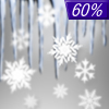 |
Thursday Night... A chance of drizzle or freezing rain before 7pm, then a chance of drizzle, snow showers, and freezing rain between 7pm and 10pm, then snow showers likely after 10pm. Mostly cloudy, with a low around 21. West wind 7 to 17 mph, with gusts as high as 29 mph. Chance of precipitation is 60%. New snow accumulation of less than one inch possible. |
|
Friday... Snow showers likely, mainly before 1pm. Mostly cloudy, with a high near 24. West wind 16 to 18 mph, with gusts as high as 31 mph. Chance of precipitation is 60%. |
|
Friday Night... A chance of snow showers. Mostly cloudy, with a low around 14. Chance of precipitation is 40%. |
|
Saturday... Mostly cloudy, with a high near 25. |
 |
Saturday Night... Snow. Low around 17. Chance of precipitation is 90%. |
|
Sunday... A chance of snow before 1pm, then a chance of snow showers after 1pm. Mostly cloudy, with a high near 29. Chance of precipitation is 40%. |
|
Sunday Night... Mostly cloudy, with a low around 9. |
|
Monday... Mostly cloudy, with a high near 24. |
|
Monday Night... Mostly cloudy, with a low around 7. |
|
Tuesday... Mostly cloudy, with a high near 23. |