Edinburg, Virginia Weather
Issued: 9:30 am EST Feb 5, 2025 Latitude: 38.8209466 Longitude: -78.5658453 View on Google Maps
|
|
|
|
|
|
|
|
|
|
 |
 |
 |
 |
 |
 |
 |
 |
| High: °F |
Low: °F |
High: °F |
High: °F |
High: °F |
High: °F |
High: °F |
High: °F |
| Low: °F |
Low: °F |
Low: °F |
Low: °F |
Low: °F |
|
| Rain |
Freezing Rain |
Rain |
Sunny |
Freezing Rain & Snow |
Mostly Sunny |
Snow |
Snow |
Current Conditions at
WINCHESTER RGNL - (KOKV)
32°
Cloudy
as of 9:35 AM EST
Rel. Humidity: 54%
Dew Point: 18°F
Visibility: 10 Miles
Pressure: 30.40 in.
Flight Rule: VFR
Cloud Level(s): Solid Overcast at 7000ft
Current Conditions at
PETERSBURG - (KW99)
32°
Cloudy
as of 9:35 AM EST
Rel. Humidity: 68%
Dew Point: 23°F
Visibility: 10 Miles
Pressure: 30.37 in.
Flight Rule: VFR
Cloud Level(s): Solid Overcast at 6000ft
Current Conditions at
STAUNTON - (KSHD)
34°
Cloudy
as of 9:35 AM EST
Rel. Humidity: 64%
Dew Point: 23°F
Visibility: 10 Miles
Pressure: 30.37 in.
Flight Rule: VFR
Wind Data
7 MPH
040° Northeast
Cloud Level(s): Solid Overcast at 3700ft
Current Conditions at
LEESBURG/GODFREY - (KJYO)
34°
Cloudy
as of 9:35 AM EST
Rel. Humidity: 59%
Dew Point: 21°F
Visibility: 10 Miles
Pressure: 30.44 in.
Flight Rule: VFR
Wind Data
5 MPH
030° Northeast
Cloud Level(s): Solid Overcast at 8000ft
|
Today... A slight chance of sleet between 1pm and 4pm, then a slight chance of rain after 4pm. Cloudy, with a high near 36. Calm wind. Chance of precipitation is 20%. |
|
|
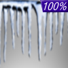
Tonight... Rain, freezing rain, and sleet before 1am, then rain or freezing rain between 1am and 5am, then rain and freezing rain, possibly mixed with sleet after 5am. Low around 31. Calm wind becoming south around 5 mph after midnight. Chance of precipitation is 100%. New ice accumulation of 0.1 to 0.2 of an inch possible. Little or no sleet accumulation expected. |
|
|
Thursday... Rain, mainly before 1pm. High near 57. Southwest wind 6 to 10 mph, with gusts as high as 22 mph. Chance of precipitation is 90%. New precipitation amounts between a tenth and quarter of an inch possible. |
|
 |
Thursday Night... Mostly cloudy, with a low around 38. West wind around 7 mph, with gusts as high as 18 mph. |
|
|
Friday... Sunny, with a high near 54. West wind 5 to 8 mph, with gusts as high as 21 mph. |
|
 |
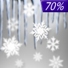
Friday Night... A slight chance of rain and snow between 1am and 4am, then a slight chance of snow after 4am. Partly cloudy, with a low around 28. Chance of precipitation is 20%. |
|
|
Saturday... A chance of snow and freezing rain before 7am, then a chance of rain, snow, and freezing rain between 7am and 1pm, then rain likely after 1pm. Cloudy, with a high near 43. Chance of precipitation is 70%. |
|
 |
Saturday Night... Rain likely, mainly before 1am. Mostly cloudy, with a low around 35. Chance of precipitation is 70%. |
|
|
Sunday... Mostly sunny, with a high near 52. |
|
 |
Sunday Night... A chance of snow after 1am. Mostly cloudy, with a low around 27. Chance of precipitation is 30%. |
|
|
Monday... A chance of snow. Partly sunny, with a high near 39. Chance of precipitation is 40%. |
|
 |
Monday Night... A chance of snow. Mostly cloudy, with a low around 28. Chance of precipitation is 50%. |
|
|
Tuesday... Snow. High near 38. Chance of precipitation is 80%. |
|
Current Radar Image
Sun Almanac for Edinburg, Virginia
Sunrise: 07:16 AM
Sunset: 5:41 PM
Civil Sunrise:06:48 AM
Civil Sunset: 6:08 PM
Nautical Sunrise: 06:17 AM
Nautical Sunset: 6:40 PM
Astro Sunrise: 05:45 AM
Astro Sunset: 7:11 PM
Virginia's Current Temperatures
 Virginia's Satellite Image
 Virginia's Current Wind Direction
| National Summary |
of upper and lower values of current conditions amongst 7125 locations
in the contiguous United States |
|
High
Temp |
79° |
Keathley C 875, Louisiana
|
|
Low
Temp |
-13° |
Foxtrot, Montana
|
|
Wind
Speed |
33mph |
Elk Mountain, Wyoming
|
|
Wind
Gust |
47mph |
Salmon, Idaho
|
|
Wind
Chill |
-28° |
Helena, Montana
|
|
High
Pressure |
30.51Hg |
Massena, New York
|
|
Low
Pressure |
29.48Hg |
Mullan Pass, Idaho
and 1 other location
|
|
| # Locations Reporting Snow |
59 |
|
| # Locations Reporting Rain |
39 |
|
| # Locations Reporting Fog |
74 |
|
| Average Temperature in the Contiguous USA |
35° |
|
Any use of the information on this page is at your own risk. This information should not be relied upon in life-threatening situations, potential financial loss situations or in lieu of any officially disseminated information. Visit the
National Weather Service for official information.


