Eaton Place, New Mexico Weather
Issued: 11:14 pm MDT Mar 13, 2025 Latitude: 31.6806534 Longitude: -108.9367216 View on Google Maps
|
|
|
|
|
|
|
|
|
|
 |
 |
 |
 |
|
|
|
|
| Low: °F |
High: °F |
High: °F |
High: °F |
High: °F |
High: °F |
High: °F |
High: °F |
| Low: °F |
Low: °F |
Low: °F |
Low: °F |
Low: °F |
Low: °F |
|
| Rain & Snow |
Mostly Sunny |
Rain & Snow |
Sunny |
Mostly Sunny |
Sunny |
Sunny |
Sunny |
Current Conditions at
DOUGLAS - (KDUG)
Cloudy
Light Rain
as of 11:56 PM MDST
Rel. Humidity: 75%
Dew Point: 39°F
Visibility: 10 Miles
Pressure: 29.87 in.
Flight Rule: VFR
Wind Data
26 MPH
Gust: 44 MPH
260° West
Cloud Level(s): Solid Overcast at 4100ft
Current Conditions at
SILVER CITY - (KSVC)
Cloudy
Light Snow
as of 11:55 PM MDST
Rel. Humidity: 93%
Dew Point: 32°F
Visibility: 1 1/4 Miles
Pressure: 29.76 in.
Flight Rule: IFR
Wind Data
20 MPH
Gust: 29 MPH
280° West
Cloud Level(s): Broken at 800ft, Solid Overcast at 1500ft
Current Conditions at
FT HUACHUCA - (KFHU)
Cloudy
Light Rain
as of 12:00 AM MDST
Rel. Humidity: 86%
Dew Point: 39°F
Visibility: 8 Miles
Pressure: 29.90 in.
Flight Rule: VFR
Wind Data
22 MPH
Gust: 29 MPH
280° West
Cloud Level(s): Scattered at 2500ft, Broken at 3100ft, Broken at 4000ft, Solid Overcast at 4700ft
Current Conditions at
DEMING - (KDMN)
Cloudy
Light Rain
as of 12:03 AM MDST
Rel. Humidity: 66%
Dew Point: 39°F
Visibility: 1 1/2 Miles
Pressure: 29.75 in.
Flight Rule: IFR
Wind Data
31 MPH
Gust: 49 MPH
280° West
Cloud Level(s): Broken at 3000ft, Solid Overcast at 7000ft
|
Overnight... Scattered rain and snow showers before 1am. Mostly cloudy, with a low around 30. Windy, with a west wind 34 to 39 mph decreasing to 25 to 30 mph. Winds could gust as high as 55 mph. Chance of precipitation is 40%. Little or no snow accumulation expected. |
|
|
Friday... Mostly sunny, with a high near 45. Windy, with a west wind 23 to 26 mph, with gusts as high as 39 mph. |
|
 |
Friday Night... Scattered rain and snow showers after midnight. Partly cloudy, with a low around 34. Windy, with a west southwest wind 23 to 25 mph, with gusts as high as 39 mph. Chance of precipitation is 50%. New snow accumulation of less than a half inch possible. |
|
|
Saturday... Rain and snow showers likely, becoming all rain after 9am. Mostly cloudy, then gradually becoming sunny, with a high near 50. Windy, with a west wind 25 to 29 mph, with gusts as high as 39 mph. Chance of precipitation is 70%. |
|
 |
Saturday Night... Mostly clear, with a low around 31. West northwest wind 19 to 24 mph decreasing to 6 to 11 mph after midnight. Winds could gust as high as 32 mph. |
|
|
Sunday... Sunny, with a high near 64. North northwest wind 6 to 9 mph becoming east in the afternoon. |
|
 |
Sunday Night... Partly cloudy, with a low around 41. East wind 8 to 10 mph. |
|
|
Monday... Mostly sunny, with a high near 74. East wind 9 to 14 mph becoming southwest 18 to 23 mph in the afternoon. Winds could gust as high as 30 mph. |
|
|
Monday Night... Partly cloudy, with a low around 47. Southwest wind 20 to 23 mph, with gusts as high as 30 mph. |
|
|
Tuesday... Sunny, with a high near 65. Windy. |
|
|
Tuesday Night... Mostly clear, with a low around 34. Windy. |
|
|
Wednesday... Sunny, with a high near 59. |
|
|
Wednesday Night... Mostly clear, with a low around 35. |
|
|
Thursday... Sunny, with a high near 67. |
|
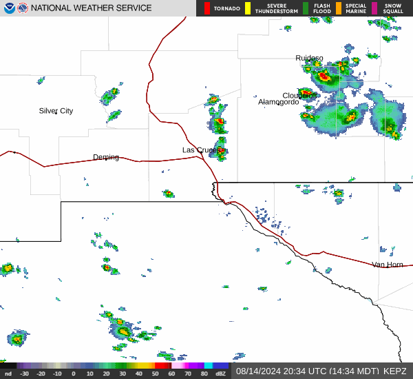
Current Radar Image
Sun Almanac for Eaton Place, New Mexico
Sunrise: 07:26 AM
Sunset: 7:23 PM
Civil Sunrise:07:02 AM
Civil Sunset: 7:48 PM
Nautical Sunrise: 06:34 AM
Nautical Sunset: 8:16 PM
Astro Sunrise: 06:05 AM
Astro Sunset: 8:44 PM
New Mexico's Current Temperatures
 New Mexico's Satellite Image
 New Mexico's Current Wind Direction
| National Summary |
of upper and lower values of current conditions amongst 6833 locations
in the contiguous United States |
|
High
Temp |
81° |
Faith Ranch A/P, Texas
|
|
Low
Temp |
18° |
Stanley Ranger Stn, Idaho
|
|
Wind
Speed |
35mph |
Ruidoso, New Mexico
|
|
Wind
Gust |
55mph |
Albuquerque, New Mexico
|
|
Wind
Chill |
1° |
Pagosa Springs, Colorado
|
|
High
Pressure |
30.21Hg |
Bar Harbor, Maine
and 1 other location
|
|
Low
Pressure |
29.17Hg |
Dickinson, North Dakota
|
|
| # Locations Reporting Snow |
31 |
|
| # Locations Reporting Rain |
19 |
|
| # Locations Reporting Thunderstorms / Lightning |
1 |
|
| # Locations Reporting Fog |
15 |
|
| Average Temperature in the Contiguous USA |
49° |
|
Any use of the information on this page is at your own risk. This information should not be relied upon in life-threatening situations, potential financial loss situations or in lieu of any officially disseminated information. Visit the
National Weather Service for official information.