
| your sport, your way | ||||
 |  |  |  |  |
|

| Today | Tonight | Thursday | Friday | Saturday | Sunday | Monday | Tuesday |
 |
 |
 |
 |
 |
 |
 |
 |
| High: 35°F | Low: 30°F | High: 54°F | High: 57°F | High: 41°F | High: 53°F | High: 37°F | High: 37°F |
| Low: 40°F | Low: 30°F | Low: 36°F | Low: 27°F | Low: 30°F | |||
| Freezing Rain | Freezing Rain | Thunderstorms | Sunny | Freezing Rain & Snow | Mostly Sunny | Snow | Snow |


|
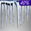
Today... A slight chance of freezing rain before 10am, then a chance of sleet between 10am and 4pm, then a chance of rain after 4pm. Cloudy, with a high near 35. Light east wind. Chance of precipitation is 40%. |
|
Tonight... Freezing rain and sleet likely, possibly mixed with rain before 8pm, then freezing rain likely, possibly mixed with sleet between 8pm and 1am, then freezing rain after 1am. Some thunder is also possible. Low around 30. Southeast wind around 6 mph. Chance of precipitation is 90%. New ice accumulation of 0.1 to 0.3 of an inch possible. New sleet accumulation of less than a half inch possible. |
|
Thursday... Rain and possibly a thunderstorm before 10am, then rain likely. High near 54. South wind 7 to 13 mph becoming southwest in the morning. Winds could gust as high as 24 mph. Chance of precipitation is 80%. New precipitation amounts between a tenth and quarter of an inch, except higher amounts possible in thunderstorms. |
 |
Thursday Night... A slight chance of showers before 1am. Mostly cloudy, with a low around 40. West wind 8 to 10 mph, with gusts as high as 22 mph. Chance of precipitation is 20%. |
|
Friday... Sunny, with a high near 57. West wind 6 to 9 mph, with gusts as high as 21 mph. |
 |
Friday Night... A slight chance of rain and snow between 1am and 4am, then a slight chance of snow after 4am. Mostly cloudy, with a low around 30. Chance of precipitation is 20%. |
|
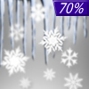
Saturday... Snow and freezing rain likely before 7am, then rain, snow, and freezing rain likely between 7am and 1pm, then rain likely after 1pm. Mostly cloudy, with a high near 41. Chance of precipitation is 70%. |
 |
Saturday Night... Rain likely, mainly before 1am. Mostly cloudy, with a low around 36. Chance of precipitation is 60%. |
|
Sunday... Mostly sunny, with a high near 53. |
 |
Sunday Night... A chance of snow after 1am. Mostly cloudy, with a low around 27. Chance of precipitation is 30%. |
|
Monday... A chance of snow. Partly sunny, with a high near 37. Chance of precipitation is 50%. |
|
Monday Night... A chance of snow. Mostly cloudy, with a low around 30. Chance of precipitation is 50%. |
|
Tuesday... Snow. High near 37. Chance of precipitation is 80%. |


