Aylor, Maryland Weather
your sport, your way
Air Sports Net on FacebookAir Sports Net on Google +Air Sports Net on TwitterReceive RSS UpdatesReceive Email Updates

Change location by the zip code or city,state: or search for other weather forecast locations in Maryland by name.
Weather Forecast for Aylor, Maryland : Frederick County
Issued: 9:30 pm EST Feb 4, 2025 Latitude: 39.3834359 Longitude: -77.3691515 View on Google Maps

MouseOver for Detail Forecast
Tonight Wednesday Thursday Friday Saturday Sunday Monday Tuesday
20% chance of snow on Tonight 40% chance of rain & snow on Wednesday 90% chance of rain & sleet on Thursday Sunny on Friday 80% chance of snow on Saturday 30% chance of rain on Sunday Mostly Sunny on Monday 50% chance of snow on Tuesday
Low: 30°F High: 37°F High: 45°F High: 47°F High: 39°F High: 49°F High: 41°F High: 38°F
Low: 31°F Low: 38°F Low: 28°F Low: 34°F Low: 26°F Low: 26°F  
Snow Rain & Snow Rain & Sleet Sunny Snow Rain Mostly Sunny Snow
-
Current Conditions at
FREDERICK MUNICIPAL AIR - (KFDK)
34°
Clear
as of 11:30 PM EST
Rel. Humidity: 50%
Dew Point: 18°F
Pressure: 30.34 in.
Wind Data
Calm
Cloud Level(s): Clear
Current Conditions at
CARROLL CNTY ARPT - (KDMW)
34°
Clear
as of 11:25 PM EST
Rel. Humidity: 50%
Dew Point: 18°F
Visibility: 10 Miles
Pressure: 30.29 in.
Flight Rule: VFR
Wind Data
3 MPH
340° North
Cloud Level(s): Clear
Current Conditions at
LEESBURG/GODFREY - (KJYO)
34°
Clear
as of 11:35 PM EST
Rel. Humidity: 59%
Dew Point: 21°F
Visibility: 10 Miles
Pressure: 30.34 in.
Flight Rule: VFR
Wind Data
3 MPH
350° North
Cloud Level(s): Clear
Current Conditions at
HAGERSTOWN - (KHGR)
34°
Feels like 26°F
Clear
as of 10:53 PM EST
Rel. Humidity: 50%
Dew Point: 18°F
Visibility: 10 Miles
Pressure: 30.31 in.
Flight Rule: VFR
Wind Data
9 MPH
340° North
Cloud Level(s): Clear
20% chance of snow Tonight Tonight... A slight chance of snow after 4am. Mostly cloudy, with a low around 30. North wind around 6 mph. Chance of precipitation is 20%.

40% chance of rain & snow Wednesday Wednesday... A chance of snow before 4pm, then a chance of rain and snow. Cloudy, with a high near 37. Northeast wind around 5 mph becoming light and variable. Chance of precipitation is 40%.

100% chance of freezing rain & snow Wednesday Night Wednesday Night... Sleet likely, possibly mixed with rain, snow, and freezing rain before 1am, then freezing rain and sleet between 1am and 4am, then rain and freezing rain, possibly mixed with sleet after 4am. Low around 31. Southeast wind 5 to 9 mph. Chance of precipitation is 100%. New ice accumulation of 0.1 to 0.2 of an inch possible. New snow and sleet accumulation of less than a half inch possible.

90% chance of rain & sleet Thursday 
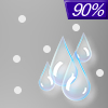
Thursday... Rain, possibly mixed with sleet, becoming all rain after 7am. High near 45. South wind around 9 mph. Chance of precipitation is 90%. New sleet accumulation of less than a half inch possible.

30% chance of rain Thursday Night Thursday Night... A chance of rain before 1am. Mostly cloudy, with a low around 38. Light and variable wind becoming west around 6 mph after midnight. Chance of precipitation is 30%.

Sunny on Friday Friday... Sunny, with a high near 47.

Mostly Cloudy on Friday Night Friday Night... Mostly cloudy, with a low around 28.

80% chance of snow Saturday Saturday... Snow likely before 1pm, then rain. High near 39. Chance of precipitation is 80%.

80% chance of rain Saturday Night Saturday Night... Rain, mainly before 1am. Low around 34. Chance of precipitation is 80%.

30% chance of rain Sunday Sunday... A chance of rain before 1pm. Partly sunny, with a high near 49. Chance of precipitation is 30%.

Cloudy on Sunday Night Sunday Night... Partly cloudy, with a low around 26.

Mostly Sunny on Monday Monday... Mostly sunny, with a high near 41.

Mostly Cloudy on Monday Night Monday Night... Mostly cloudy, with a low around 26.

50% chance of snow Tuesday Tuesday... A chance of snow. Mostly cloudy, with a high near 38. Chance of precipitation is 50%.

Current Radar Image


Sun Almanac for Aylor, Maryland
Sunrise: 07:13 AM
Sunset: 5:34 PM
Civil Sunrise:06:45 AM
Civil Sunset: 6:02 PM
Nautical Sunrise: 06:13 AM
Nautical Sunset: 6:34 PM
Astro Sunrise: 05:42 AM
Astro Sunset: 7:05 PM
Any use of the information on this page is at your own risk. This information should not be relied upon in life-threatening situations, potential financial loss situations or in lieu of any officially disseminated information. Visit the National Weather Service for official information.