
| your sport, your way | ||||
 |  |  |  |  |
|

| Today | Tonight | Thursday | Friday | Saturday | Sunday | Monday | Tuesday |
 |
 |
 |
 |
 |
 |
 |
 |
| High: 35°F | Low: 31°F | High: 54°F | High: 57°F | High: 39°F | High: 54°F | High: 38°F | High: 36°F |
| Low: 41°F | Low: 30°F | Low: 36°F | Low: 28°F | Low: 30°F | |||
| Freezing Rain | Freezing Rain | Thunderstorms | Sunny | Freezing Rain & Snow | Mostly Sunny | Snow | Snow |


|
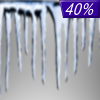
Today... A slight chance of rain or freezing rain before 1pm, then a chance of freezing rain between 1pm and 2pm, then a chance of rain after 2pm. Cloudy, with a high near 35. East wind around 6 mph. Chance of precipitation is 40%. |
|
Tonight... Rain and freezing rain, possibly mixed with sleet, becoming all rain after 4am. Some thunder is also possible. Low around 31. Southeast wind around 5 mph becoming light and variable. Chance of precipitation is 90%. New ice accumulation of less than a 0.1 of an inch possible. Little or no sleet accumulation expected. |
|
Thursday... Rain and possibly a thunderstorm before 1pm, then a chance of rain. High near 54. Southwest wind 7 to 15 mph, with gusts as high as 20 mph. Chance of precipitation is 80%. New precipitation amounts between a tenth and quarter of an inch, except higher amounts possible in thunderstorms. |
 |
Thursday Night... A chance of rain, mainly between 7pm and 1am. Mostly cloudy, with a low around 41. Southwest wind around 10 mph, with gusts as high as 22 mph. Chance of precipitation is 40%. |
|
Friday... Sunny, with a high near 57. West wind 6 to 10 mph, with gusts as high as 21 mph. |
 |
Friday Night... A chance of rain and snow after 1am. Mostly cloudy, with a low around 30. Chance of precipitation is 30%. |
|
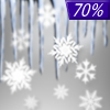
Saturday... Snow, freezing rain, and sleet likely before 1pm, then a chance of snow. Mostly cloudy, with a high near 39. Chance of precipitation is 70%. |
|
Saturday Night... A chance of rain. Mostly cloudy, with a low around 36. Chance of precipitation is 40%. |
|
Sunday... Mostly sunny, with a high near 54. |
 |
Sunday Night... A chance of snow after 1am. Mostly cloudy, with a low around 28. Chance of precipitation is 40%. |
|
Monday... A chance of snow. Mostly cloudy, with a high near 38. Chance of precipitation is 50%. |
|
Monday Night... A chance of snow. Mostly cloudy, with a low around 30. Chance of precipitation is 50%. |
|
Tuesday... Snow. High near 36. Chance of precipitation is 80%. |


