Arenas Valley, New Mexico Weather
Issued: 1:14 pm MDT Mar 13, 2025 Latitude: 32.7939639 Longitude: -108.1842122 View on Google Maps
|
|
|
|
|
|
|
|
|
|
 |
 |
|
 |
 |
 |
|
|
| High: °F |
Low: °F |
High: °F |
High: °F |
High: °F |
High: °F |
High: °F |
High: °F |
| Low: °F |
Low: °F |
Low: °F |
Low: °F |
Low: °F |
|
| Rain |
Blowing Snow |
Blowing Snow |
Rain & Snow |
Sunny |
Mostly Sunny |
Sunny |
Sunny |
Current Conditions at
SILVER CITY - (KSVC)
63°
Clear
as of 12:55 PM MDST
Rel. Humidity: 14%
Dew Point: 14°F
Visibility: 10 Miles
Pressure: 29.95 in.
Flight Rule: VFR
Wind Data
13 MPH
Gust: 21 MPH
230° Southwest
Cloud Level(s): Clear
Current Conditions at
DEMING - (KDMN)
70°
Clear
as of 12:53 PM MDST
Rel. Humidity: 19%
Dew Point: 27°F
Visibility: 10 Miles
Pressure: 29.92 in.
Flight Rule: VFR
Wind Data
17 MPH
Gust: 24 MPH
220° Southwest
Cloud Level(s): Clear
Current Conditions at
TRUTH OR CONSQ - (KTCS)
68°
Clear
as of 12:53 PM MDST
Rel. Humidity: 14%
Dew Point: 18°F
Visibility: 10 Miles
Pressure: 29.84 in.
Flight Rule: VFR
Wind Data
30 MPH
Gust: 38 MPH
200° South
Cloud Level(s): Clear
Current Conditions at
LAS CRUCES - (KLRU)
64°
Clear
as of 1:15 PM MDST
Rel. Humidity: 13%
Dew Point: 14°F
Visibility: 10 Miles
Pressure: 29.93 in.
Flight Rule: VFR
Wind Data
15 MPH
Gust: 24 MPH
240° Southwest
Cloud Level(s): Clear
|
This Afternoon... A 30 percent chance of rain, mainly after 5pm. Increasing clouds, with a high near 60. Windy, with a west southwest wind 20 to 30 mph, with gusts as high as 41 mph. |
|
|
Tonight... Rain and snow showers, becoming all snow after 1am. Patchy blowing snow after 1am. Low around 23. Wind chill values as low as 10. Windy, with a west wind 25 to 33 mph, with gusts as high as 44 mph. Chance of precipitation is 90%. New snow accumulation of around an inch possible. |
|
|
Friday... Patchy blowing snow before noon. Mostly sunny, with a high near 40. Wind chill values as low as 7. Windy, with a west northwest wind 23 to 29 mph, with gusts as high as 40 mph. |
|
 |
Friday Night... A slight chance of rain and snow showers before 9pm, then snow showers likely. Mostly cloudy, with a low around 27. Windy, with a west northwest wind 23 to 28 mph decreasing to 17 to 22 mph after midnight. Winds could gust as high as 37 mph. Chance of precipitation is 60%. |
|
|
Saturday... Snow showers likely before 9am, then rain and snow showers likely between 9am and noon, then scattered rain showers after noon. Partly sunny, with a high near 42. Windy, with a west wind 18 to 28 mph, with gusts as high as 37 mph. Chance of precipitation is 70%. |
|
 |
Saturday Night... Mostly clear, with a low around 24. Windy, with a west northwest wind 20 to 25 mph decreasing to 7 to 12 mph after midnight. Winds could gust as high as 34 mph. |
|
|
Sunday... Sunny, with a high near 59. North wind 5 to 9 mph becoming south in the morning. |
|
 |
Sunday Night... Partly cloudy, with a low around 36. South southwest wind 6 to 9 mph becoming north northeast in the evening. |
|
|
Monday... Mostly sunny, with a high near 68. Northeast wind 6 to 11 mph becoming west southwest 12 to 17 mph in the afternoon. Winds could gust as high as 23 mph. |
|
|
Monday Night... Partly cloudy, with a low around 41. |
|
|
Tuesday... Sunny, with a high near 59. Windy. |
|
|
Tuesday Night... Mostly clear, with a low around 29. Windy. |
|
|
Wednesday... Sunny, with a high near 57. |
|
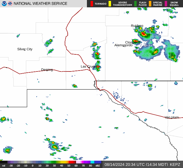
Current Radar Image
Sun Almanac for Arenas Valley, New Mexico
Sunrise: 07:25 AM
Sunset: 7:19 PM
Civil Sunrise:07:00 AM
Civil Sunset: 7:44 PM
Nautical Sunrise: 06:32 AM
Nautical Sunset: 8:13 PM
Astro Sunrise: 06:03 AM
Astro Sunset: 8:41 PM
New Mexico's Current Temperatures
 New Mexico's Satellite Image
 New Mexico's Current Wind Direction
| National Summary |
of upper and lower values of current conditions amongst 6974 locations
in the contiguous United States |
|
High
Temp |
93° |
Cotulla, Texas
and 2 other locations
|
|
Low
Temp |
19° |
Pagosa Springs, Colorado
|
|
Wind
Speed |
41mph |
Winslow, Arizona
|
|
Wind
Gust |
58mph |
Mercury, Nevada
|
|
Wind
Chill |
1° |
Pagosa Springs, Colorado
|
|
High
Pressure |
30.26Hg |
Bar Harbor, Maine
|
|
Low
Pressure |
29.24Hg |
Golf, Montana
and 2 other locations
|
|
| # Locations Reporting Snow |
12 |
|
| # Locations Reporting Rain |
50 |
|
| # Locations Reporting Thunderstorms / Lightning |
8 |
|
| Average Temperature in the Contiguous USA |
63° |
|
Any use of the information on this page is at your own risk. This information should not be relied upon in life-threatening situations, potential financial loss situations or in lieu of any officially disseminated information. Visit the
National Weather Service for official information.