Ancient Oak, Maryland Weather
Issued: 9:30 pm EST Feb 4, 2025 Latitude: 39.1117744 Longitude: -77.2705384 View on Google Maps
|
|
|
|
|
|
|
|
|
|
 |
 |
 |
 |
 |
 |
 |
 |
| Low: °F |
High: °F |
High: °F |
High: °F |
High: °F |
High: °F |
High: °F |
High: °F |
| Low: °F |
Low: °F |
Low: °F |
Low: °F |
Low: °F |
Low: °F |
|
| Snow |
Snow & Sleet |
Rain & Sleet |
Sunny |
Rain & Snow |
Rain |
Mostly Sunny |
Snow |
Current Conditions at
WASH-DULLES - (KIAD)
36°
Mostly Clear
as of 10:52 PM EST
Rel. Humidity: 47%
Dew Point: 18°F
Visibility: 10 Miles
Pressure: 30.32 in.
Flight Rule: VFR
Cloud Level(s): Few at 10000ft
Current Conditions at
LEESBURG/GODFREY - (KJYO)
34°
Clear
as of 11:15 PM EST
Rel. Humidity: 59%
Dew Point: 21°F
Visibility: 10 Miles
Pressure: 30.33 in.
Flight Rule: VFR
Cloud Level(s): Clear
Current Conditions at
FREDERICK MUNICIPAL AIR - (KFDK)
32°
Clear
as of 11:10 PM EST
Rel. Humidity: 59%
Dew Point: 19°F
Pressure: 30.33 in.
Wind Data
5 MPH
330° Northwest
Cloud Level(s): Clear
Current Conditions at
CARROLL CNTY ARPT - (KDMW)
34°
Clear
as of 11:00 PM EST
Rel. Humidity: 50%
Dew Point: 18°F
Visibility: 10 Miles
Pressure: 30.29 in.
Flight Rule: VFR
Wind Data
3 MPH
330° Northwest
Cloud Level(s): Clear
|
Tonight... A slight chance of snow after 4am. Mostly cloudy, with a low around 30. West wind 5 to 7 mph becoming north after midnight. Chance of precipitation is 20%. |
|
|
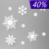
Wednesday... A chance of snow and sleet before 4pm, then a chance of rain and snow. Cloudy, with a high near 37. Light and variable wind becoming northeast around 5 mph in the afternoon. Chance of precipitation is 40%. |
|
 |
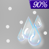
Wednesday Night... Rain, snow, and sleet likely before 1am, then freezing rain and sleet between 1am and 4am, then rain and freezing rain, possibly mixed with sleet after 4am. Low around 31. Southeast wind 6 to 8 mph. Chance of precipitation is 100%. New ice accumulation of less than a 0.1 of an inch possible. New snow and sleet accumulation of less than a half inch possible. |
|
|
Thursday... Rain, possibly mixed with sleet, becoming all rain after 7am. High near 47. South wind 7 to 9 mph. Chance of precipitation is 90%. New sleet accumulation of less than a half inch possible. |
|
 |
Thursday Night... A chance of rain before 1am. Mostly cloudy, with a low around 39. Southwest wind 6 to 8 mph becoming northwest after midnight. Chance of precipitation is 30%. |
|
|
Friday... Sunny, with a high near 48. |
|
 |
Friday Night... Mostly cloudy, with a low around 29. |
|
|
Saturday... Rain and snow likely before 1pm, then rain. High near 39. Chance of precipitation is 80%. |
|
 |
Saturday Night... Rain likely, mainly before 1am. Cloudy, with a low around 34. Chance of precipitation is 70%. |
|
|
Sunday... A chance of rain before 1pm. Partly sunny, with a high near 50. Chance of precipitation is 30%. |
|
 |
Sunday Night... Partly cloudy, with a low around 28. |
|
|
Monday... Mostly sunny, with a high near 41. |
|
|
Monday Night... Mostly cloudy, with a low around 27. |
|
|
Tuesday... A chance of snow. Mostly cloudy, with a high near 38. Chance of precipitation is 50%. |
|
Current Radar Image
Sun Almanac for Ancient Oak, Maryland
Sunrise: 07:12 AM
Sunset: 5:34 PM
Civil Sunrise:06:44 AM
Civil Sunset: 6:02 PM
Nautical Sunrise: 06:13 AM
Nautical Sunset: 6:33 PM
Astro Sunrise: 05:41 AM
Astro Sunset: 7:05 PM
Maryland's Current Temperatures
 Maryland's Satellite Image
 Maryland's Current Wind Direction
| National Summary |
of upper and lower values of current conditions amongst 6832 locations
in the contiguous United States |
|
High
Temp |
79° |
Keathley C 875, Louisiana
|
|
Low
Temp |
-17° |
Crane Lake, Minnesota
|
|
Wind
Speed |
31mph |
Castle AFB, California
and 1 other location
|
|
Wind
Gust |
43mph |
Frenchville, Maine
|
|
Wind
Chill |
-27° |
Golf, Montana
and 1 other location
|
|
High
Pressure |
30.57Hg |
Superior, Wisconsin
and 2 other locations
|
|
Low
Pressure |
29.40Hg |
Mountain Home AFB, Idaho
|
|
| # Locations Reporting Snow |
56 |
|
| # Locations Reporting Rain |
29 |
|
| # Locations Reporting Fog |
34 |
|
| Average Temperature in the Contiguous USA |
37° |
|
Any use of the information on this page is at your own risk. This information should not be relied upon in life-threatening situations, potential financial loss situations or in lieu of any officially disseminated information. Visit the
National Weather Service for official information.


