Ambar, Virginia Weather
your sport, your way
Air Sports Net on FacebookAir Sports Net on Google +Air Sports Net on TwitterReceive RSS UpdatesReceive Email Updates

Change location by the zip code or city,state: or search for other weather forecast locations in Virginia by name.
Weather Forecast for Ambar, Virginia : King George County
Issued: 6:30 am EST Feb 5, 2025 Latitude: 38.3251265 Longitude: -77.1780334 View on Google Maps

MouseOver for Detail Forecast
Today Tonight Thursday Friday Saturday Sunday Monday Tuesday
30% chance of snow & sleet on Today 90% chance of freezing rain on Tonight 90% chance of rain on Thursday Sunny on Friday 70% chance of freezing rain & snow on Saturday Mostly Sunny on Sunday 50% chance of snow on Monday 80% chance of rain & snow on Tuesday
High: 37°F Low: 32°F High: 54°F High: 56°F High: 39°F High: 58°F High: 38°F High: 38°F
Low: 42°F Low: 30°F Low: 36°F Low: 31°F Low: 31°F  
Snow & Sleet Freezing Rain Rain Sunny Freezing Rain & Snow Mostly Sunny Snow Rain & Snow
-
Current Conditions at
QUANTICO MCAS - (KNYG)
37°
Cloudy
as of 5:56 AM EST
Rel. Humidity: 19%
Visibility: 10 Miles
Pressure: 30.39 in.
Flight Rule: VFR
Wind Data
5 MPH
320° Northwest
Cloud Level(s): Scattered at 7000ft, Solid Overcast at 8000ft
Current Conditions at
SHANNON ARPT - (KEZF)
39°
Cloudy
as of 6:35 AM EST
Rel. Humidity: 44%
Dew Point: 19°F
Visibility: 10 Miles
Pressure: 30.36 in.
Flight Rule: VFR
Wind Data
3 MPH
010° North
Cloud Level(s): Broken at 6500ft, Solid Overcast at 7000ft
Current Conditions at
STAFFORD - (KRMN)
37°
Cloudy
as of 6:35 AM EST
Rel. Humidity: 44%
Dew Point: 18°F
Visibility: 10 Miles
Pressure: 30.35 in.
Flight Rule: VFR
Wind Data
5 MPH
0° North
Cloud Level(s): Solid Overcast at 6500ft
Current Conditions at
FORT BELVOIR - (KDAA)
36°
Clear
as of 5:55 AM EST
Rel. Humidity: 47%
Dew Point: 18°F
Visibility: 10 Miles
Pressure: 30.35 in.
Flight Rule: VFR
Wind Data
5 MPH
310° Northwest
Cloud Level(s): Clear
30% chance of snow & sleet Today Today... A chance of snow before 3pm, then a chance of sleet between 3pm and 4pm, then a chance of rain after 4pm. Cloudy, with a high near 37. North wind around 5 mph becoming light and variable. Chance of precipitation is 30%.

90% chance of freezing rain Tonight Tonight... Freezing rain and sleet likely before midnight, then rain and freezing rain likely, possibly mixed with sleet between midnight and 1am, then rain or freezing rain after 1am. Low around 32. East wind around 5 mph. Chance of precipitation is 90%. New ice accumulation of around a 0.1 of an inch possible. Little or no sleet accumulation expected.

90% chance of rain Thursday Thursday... Rain, mainly before 1pm. High near 54. Light south wind becoming southwest 9 to 14 mph in the morning. Winds could gust as high as 18 mph. Chance of precipitation is 90%. New precipitation amounts between a tenth and quarter of an inch possible.

40% chance of rain Thursday Night Thursday Night... A chance of rain, mainly before 1am. Mostly cloudy, with a low around 42. Southwest wind 6 to 9 mph becoming west after midnight. Chance of precipitation is 40%.

Sunny on Friday Friday... Sunny, with a high near 56. Northwest wind around 7 mph.

20% chance of rain & snow Friday Night Friday Night... A slight chance of rain and snow after 1am. Partly cloudy, with a low around 30. Chance of precipitation is 20%.

70% chance of freezing rain & snow Saturday 
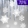
Saturday... A chance of snow, freezing rain, and sleet before 1pm, then snow likely. Mostly cloudy, with a high near 39. Chance of precipitation is 70%.

50% chance of rain Saturday Night Saturday Night... A chance of rain. Mostly cloudy, with a low around 36. Chance of precipitation is 50%.

Mostly Sunny on Sunday Sunday... Mostly sunny, with a high near 58.

Cloudy on Sunday Night Sunday Night... Partly cloudy, with a low around 31.

50% chance of snow Monday Monday... A chance of snow. Partly sunny, with a high near 38. Chance of precipitation is 50%.

50% chance of snow Monday Night Monday Night... A chance of snow. Mostly cloudy, with a low around 31. Chance of precipitation is 50%.

80% chance of rain & snow Tuesday Tuesday... Rain and snow. High near 38. Chance of precipitation is 80%.

Current Radar Image


Sun Almanac for Ambar, Virginia
Sunrise: 07:10 AM
Sunset: 5:36 PM
Civil Sunrise:06:42 AM
Civil Sunset: 6:04 PM
Nautical Sunrise: 06:11 AM
Nautical Sunset: 6:35 PM
Astro Sunrise: 05:40 AM
Astro Sunset: 7:06 PM
Any use of the information on this page is at your own risk. This information should not be relied upon in life-threatening situations, potential financial loss situations or in lieu of any officially disseminated information. Visit the National Weather Service for official information.