Altona, New York Weather
your sport, your way
Air Sports Net on FacebookAir Sports Net on Google +Air Sports Net on TwitterReceive RSS UpdatesReceive Email Updates

Change location by the zip code or city,state: or search for other weather forecast locations in New York by name.
Weather Forecast for Altona, New York : Clinton County
Issued: 3:11 am EST Feb 5, 2025 Latitude: 44.8883722 Longitude: -73.6556985 View on Google Maps

MouseOver for Detail Forecast
Overnight Wednesday Thursday Friday Saturday Sunday Monday Tuesday
Cloudy on Overnight Sunny on Wednesday 80% chance of snow on Thursday Mostly Cloudy on Friday Partly Sunny on Saturday 60% chance of snow on Sunday Mostly Sunny on Monday Partly Sunny on Tuesday
Low: 1 °F High: 15°F High: 31°F High: 27°F High: 22°F High: 23°F High: 23°F High: 22°F
Low: 2 °F Low: 23°F Low: 12°F Low: 13°F Low: 8 °F Low: 9 °F  
Cloudy Sunny Snow Mostly Cloudy Partly Sunny Snow Mostly Sunny Partly Sunny
-
Current Conditions at
PLATTSBURGH AFB - (KPBG)
Mostly Cloudy
as of 2:53 AM EST
Rel. Humidity: 71%
Dew Point: -0°F
Visibility: 10 Miles
Pressure: 30.34 in.
Flight Rule: VFR
Wind Data
7 MPH
0° North
Cloud Level(s): Broken at 3700ft
Current Conditions at
BURLINGTON - (KBTV)
10°
Feels like -2°F
Cloudy
as of 2:54 AM EST
Rel. Humidity: 66%
Dew Point: 1°F
Visibility: 10 Miles
Pressure: 30.32 in.
Flight Rule: VFR
Wind Data
9 MPH
0° North
Cloud Level(s): Solid Overcast at 3400ft
Current Conditions at
SARANAC LAKE - (KSLK)
-4°
Cloudy
as of 2:51 AM EST
Rel. Humidity: 83%
Dew Point: -8°F
Visibility: 10 Miles
Pressure: 30.19 in.
Flight Rule: MVFR
Wind Data
Calm
Cloud Level(s): Solid Overcast at 2300ft
Cloudy on Overnight Overnight... Partly cloudy, with a low around 1. Wind chill values as low as -12. West wind around 9 mph.

Sunny on Wednesday Wednesday... Sunny, with a high near 15. Wind chill values as low as -12. West wind 5 to 9 mph becoming light in the afternoon.

Increasing Clouds on Wednesday Night Wednesday Night... Increasing clouds, with a low around 2. Light southwest wind.

80% chance of snow Thursday Thursday... Snow, mainly after 9am. High near 31. Wind chill values as low as -2. South wind 6 to 13 mph. Chance of precipitation is 80%. New snow accumulation of 1 to 2 inches possible.

40% chance of freezing rain & snow Thursday Night Thursday Night... A chance of freezing rain before midnight, then a chance of snow showers. Mostly cloudy, with a low around 23. South wind 10 to 15 mph becoming west after midnight. Chance of precipitation is 40%. New snow accumulation of less than a half inch possible.

Mostly Cloudy on Friday Friday... Mostly cloudy, with a high near 27. West wind 16 to 18 mph, with gusts as high as 36 mph.

Mostly Cloudy on Friday Night Friday Night... Mostly cloudy, with a low around 12. West wind 8 to 11 mph.

Partly Sunny on Saturday Saturday... Partly sunny, with a high near 22. West wind 5 to 7 mph.

80% chance of snow Saturday Night 
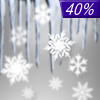
Saturday Night... Snow, mainly after 1am. Low around 13. East wind 3 to 5 mph. Chance of precipitation is 80%.

60% chance of snow Sunday Sunday... Snow likely before 1pm. Mostly cloudy, with a high near 23. Northeast wind 5 to 11 mph becoming northwest in the afternoon. Chance of precipitation is 60%.

Mostly Cloudy on Sunday Night Sunday Night... Mostly cloudy, with a low around 8. West wind 5 to 9 mph.

Mostly Sunny on Monday Monday... Mostly sunny, with a high near 23. West wind around 6 mph.

Mostly Cloudy on Monday Night Monday Night... Mostly cloudy, with a low around 9. West wind 3 to 5 mph.

Partly Sunny on Tuesday Tuesday... Partly sunny, with a high near 22. West wind 6 to 9 mph.

Current Radar Image


Sun Almanac for Altona, New York
Sunrise: 07:09 AM
Sunset: 5:09 PM
Civil Sunrise:06:38 AM
Civil Sunset: 5:40 PM
Nautical Sunrise: 06:03 AM
Nautical Sunset: 6:14 PM
Astro Sunrise: 05:29 AM
Astro Sunset: 6:49 PM
Any use of the information on this page is at your own risk. This information should not be relied upon in life-threatening situations, potential financial loss situations or in lieu of any officially disseminated information. Visit the National Weather Service for official information.