Akron, New York Weather
your sport, your way
Air Sports Net on FacebookAir Sports Net on Google +Air Sports Net on TwitterReceive RSS UpdatesReceive Email Updates

Change location by the zip code or city,state: or search for other weather forecast locations in New York by name.
Weather Forecast for Akron, New York : Erie County
Issued: 12:41 am EST Feb 5, 2025 Latitude: 43.0208924 Longitude: -78.4953015 View on Google Maps

MouseOver for Detail Forecast
Overnight Wednesday Thursday Friday Saturday Sunday Monday Tuesday
Cloudy on Overnight Partly Sunny on Wednesday 90% chance of rain, snow, & sleet on Thursday Mostly Cloudy on Friday 50% chance of snow on Saturday 30% chance of snow on Sunday Mostly Cloudy on Monday Mostly Cloudy on Tuesday
Low: 15°F High: 24°F High: 39°F High: 26°F High: 30°F High: 29°F High: 26°F High: 26°F
Low: 18°F Low: 23°F Low: 17°F Low: 24°F Low: 18°F Low: 15°F  
Cloudy Partly Sunny Rain, Snow, & Sleet Mostly Cloudy Snow Snow Mostly Cloudy Mostly Cloudy
-
Current Conditions at
BUFFALO - (KBUF)
19°
Cloudy
Light Snow
as of 2:54 AM EST
Rel. Humidity: 67%
Dew Point: 10°F
Visibility: 9 Miles
Pressure: 30.39 in.
Flight Rule: MVFR
Wind Data
5 MPH
240° Southwest
Cloud Level(s): Solid Overcast at 2800ft
Current Conditions at
NIAGARA FALLS - (KIAG)
21°
Mostly Cloudy
as of 2:53 AM EST
Rel. Humidity: 38%
Visibility: 10 Miles
Pressure: 30.39 in.
Flight Rule: VFR
Wind Data
5 MPH
250° West
Cloud Level(s): Broken at 3100ft
Current Conditions at
ROCHESTER - (KROC)
18°
Partly Cloudy
Light Snow
as of 3:20 AM EST
Rel. Humidity: 78%
Dew Point: 12°F
Visibility: 9 Miles
Pressure: 30.40 in.
Flight Rule: VFR
Wind Data
5 MPH
290° West
Cloud Level(s): Scattered at 1600ft, Scattered at 3400ft, Broken at 8000ft, Broken at 25000ft
Current Conditions at
DANSVILLE - (KDSV)
21°
Cloudy
as of 2:54 AM EST
Rel. Humidity: 67%
Dew Point: 12°F
Visibility: 10 Miles
Pressure: 30.38 in.
Flight Rule: MVFR
Wind Data
8 MPH
330° Northwest
Cloud Level(s): Scattered at 2100ft, Solid Overcast at 2600ft
Cloudy on Overnight Overnight... Cloudy, with a low around 15. Northwest wind around 7 mph.

Partly Sunny on Wednesday Wednesday... Partly sunny, with a high near 24. West wind around 6 mph becoming calm in the afternoon.

60% chance of snow Wednesday Night Wednesday Night... Snow likely, mainly after 4am. Mostly cloudy, with a low around 18. East wind 5 to 11 mph. Chance of precipitation is 60%. New snow accumulation of less than a half inch possible.

90% chance of rain, snow, & sleet Thursday Thursday... Snow before 11am, then rain and sleet between 11am and noon, then rain after noon. High near 39. Breezy, with a southeast wind 13 to 23 mph becoming southwest in the afternoon. Chance of precipitation is 90%. New snow and sleet accumulation of less than a half inch possible.

30% chance of rain & sleet Thursday Night Thursday Night... A chance of rain and sleet before 8pm, then a slight chance of snow between 8pm and 1am. Mostly cloudy, with a low around 23. Breezy, with a southwest wind 23 to 28 mph, with gusts as high as 46 mph. Chance of precipitation is 30%. New precipitation amounts of less than a tenth of an inch possible.

Mostly Cloudy on Friday Friday... Mostly cloudy, with a high near 26. Breezy, with a west wind 16 to 21 mph, with gusts as high as 33 mph.

Mostly Cloudy on Friday Night Friday Night... Mostly cloudy, with a low around 17. West wind 6 to 13 mph.

50% chance of snow Saturday 
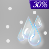
Saturday... A chance of snow showers after 1pm. Mostly cloudy, with a high near 30. Southwest wind 5 to 8 mph becoming east in the afternoon. Chance of precipitation is 50%.

90% chance of snow Saturday Night 
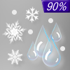
Saturday Night... Snow showers. Low around 24. Chance of precipitation is 90%.

30% chance of snow Sunday Sunday... A chance of snow showers. Cloudy, with a high near 29. Chance of precipitation is 30%.

Mostly Cloudy on Sunday Night Sunday Night... Mostly cloudy, with a low around 18.

Mostly Cloudy on Monday Monday... Mostly cloudy, with a high near 26.

Mostly Cloudy on Monday Night Monday Night... Mostly cloudy, with a low around 15.

Mostly Cloudy on Tuesday Tuesday... Mostly cloudy, with a high near 26.

Current Radar Image


Sun Almanac for Akron, New York
Sunrise: 07:24 AM
Sunset: 5:32 PM
Civil Sunrise:06:54 AM
Civil Sunset: 6:02 PM
Nautical Sunrise: 06:20 AM
Nautical Sunset: 6:36 PM
Astro Sunrise: 05:47 AM
Astro Sunset: 7:09 PM
Any use of the information on this page is at your own risk. This information should not be relied upon in life-threatening situations, potential financial loss situations or in lieu of any officially disseminated information. Visit the National Weather Service for official information.