Pinehurst, Maryland Weather
No Watches or Warnings for Pinehurst
Issued: 5:35 am EST Feb 5, 2025 Latitude: 38.3840032 Longitude: -75.1504636 View on Google Maps
|
|
|
|
|
|
|
|
|
|
 |
 |
 |
 |
 |
|
 |
 |
| High: °F |
Low: °F |
High: °F |
High: °F |
High: °F |
High: °F |
High: °F |
High: °F |
| Low: °F |
Low: °F |
Low: °F |
Low: °F |
Low: °F |
|
| Rain & Sleet |
Rain & Sleet |
Rain |
Mostly Sunny |
Rain & Snow |
Mostly Sunny |
Snow |
Rain & Snow |
Current Conditions at
OCEAN CITY - (KOXB)
28°
Clear
as of 4:53 AM EST
Rel. Humidity: 74%
Dew Point: 21°F
Visibility: 10 Miles
Pressure: 30.34 in.
Flight Rule: VFR
Wind Data
3 MPH
310° Northwest
Cloud Level(s): Clear
Current Conditions at
SALISBURY - (KSBY)
27°
Clear
as of 4:54 AM EST
Rel. Humidity: 79%
Dew Point: 21°F
Visibility: 10 Miles
Pressure: 30.34 in.
Flight Rule: VFR
Cloud Level(s): Clear
Current Conditions at
GEORGETOWN - (KGED)
34°
Clear
as of 4:54 AM EST
Rel. Humidity: 47%
Dew Point: 16°F
Visibility: 10 Miles
Pressure: 30.33 in.
Flight Rule: VFR
Cloud Level(s): Clear
Current Conditions at
WALLOPS ISLAND - (KWAL)
37°
Cloudy
as of 4:54 AM EST
Rel. Humidity: 47%
Dew Point: 19°F
Visibility: 10 Miles
Pressure: 30.34 in.
Flight Rule: VFR
Cloud Level(s): Solid Overcast at 8000ft
|
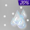
Today... A slight chance of rain and sleet after 1pm. Increasing clouds, with a high near 36. North wind around 8 mph. Chance of precipitation is 20%. |
|
|
Tonight... A chance of sleet before 8pm, then rain and sleet likely between 8pm and midnight, then rain after midnight. Low around 33. East wind 6 to 11 mph. Chance of precipitation is 90%. Little or no sleet accumulation expected. |
|
|
Thursday... Rain before 1pm, then a chance of showers after 1pm. High near 50. Southeast wind 10 to 14 mph becoming southwest in the afternoon. Winds could gust as high as 22 mph. Chance of precipitation is 100%. New precipitation amounts between a tenth and quarter of an inch possible. |
|
 |
Thursday Night... A chance of showers, mainly before 1am. Mostly cloudy, with a low around 43. Southwest wind 8 to 10 mph. Chance of precipitation is 30%. New precipitation amounts of less than a tenth of an inch possible. |
|
|
Friday... Mostly sunny, with a high near 53. Northwest wind 9 to 16 mph, with gusts as high as 24 mph. |
|
 |
Friday Night... Partly cloudy, with a low around 28. |
|
|
Saturday... A chance of rain and snow after 1pm. Mostly cloudy, with a high near 38. Chance of precipitation is 50%. |
|
 |
Saturday Night... Rain likely. Cloudy, with a low around 36. Chance of precipitation is 70%. |
|
|
Sunday... Cloudy, then gradually becoming mostly sunny, with a high near 58. |
|
|
Sunday Night... A chance of snow after 1am. Mostly cloudy, with a low around 29. Chance of precipitation is 30%. |
|
|
Monday... A chance of snow. Partly sunny, with a high near 41. Chance of precipitation is 30%. |
|
 |
Monday Night... A chance of rain and snow. Mostly cloudy, with a low around 30. Chance of precipitation is 30%. |
|
|
Tuesday... Rain and snow likely. Cloudy, with a high near 42. Chance of precipitation is 70%. |
|
Current Radar Image
Sun Almanac for Pinehurst, Maryland
Sunrise: 07:02 AM
Sunset: 5:28 PM
Civil Sunrise:06:34 AM
Civil Sunset: 5:55 PM
Nautical Sunrise: 06:02 AM
Nautical Sunset: 6:27 PM
Astro Sunrise: 05:32 AM
Astro Sunset: 6:58 PM
Maryland's Current Temperatures
 Maryland's Satellite Image
 Maryland's Current Wind Direction
| National Summary |
of upper and lower values of current conditions amongst 7002 locations
in the contiguous United States |
|
High
Temp |
75° |
Garden Banks172, Louisiana
and 1 other location
|
|
Low
Temp |
-17° |
Crane Lake, Minnesota
and 1 other location
|
|
Wind
Speed |
30mph |
Milford, Utah
and 1 other location
|
|
Wind
Gust |
47mph |
Milford, Utah
and 1 other location
|
|
Wind
Chill |
-23° |
Frenchville, Maine
|
|
High
Pressure |
30.49Hg |
Superior, Wisconsin
|
|
Low
Pressure |
29.35Hg |
Salmon, Idaho
|
|
| # Locations Reporting Snow |
67 |
|
| # Locations Reporting Rain |
35 |
|
| # Locations Reporting Fog |
96 |
|
| Average Temperature in the Contiguous USA |
34° |
|
Any use of the information on this page is at your own risk. This information should not be relied upon in life-threatening situations, potential financial loss situations or in lieu of any officially disseminated information. Visit the
National Weather Service for official information.


