Oak Hill Estates, Maryland Weather
No Watches or Warnings for Oak Hill Estates
Issued: 5:35 am EST Feb 5, 2025 Latitude: 38.2131732 Longitude: -75.2926924 View on Google Maps
|
|
|
|
|
|
|
|
|
|
 |
 |
 |
 |
 |
|
 |
 |
| High: °F |
Low: °F |
High: °F |
High: °F |
High: °F |
High: °F |
High: °F |
High: °F |
| Low: °F |
Low: °F |
Low: °F |
Low: °F |
Low: °F |
|
| Rain & Sleet |
Rain & Sleet |
Rain |
Mostly Sunny |
Rain |
Mostly Sunny |
Snow |
Rain & Snow |
Current Conditions at
OCEAN CITY - (KOXB)
28°
Clear
as of 4:53 AM EST
Rel. Humidity: 74%
Dew Point: 21°F
Visibility: 10 Miles
Pressure: 30.34 in.
Flight Rule: VFR
Wind Data
3 MPH
310° Northwest
Cloud Level(s): Clear
Current Conditions at
SALISBURY - (KSBY)
27°
Clear
as of 4:54 AM EST
Rel. Humidity: 79%
Dew Point: 21°F
Visibility: 10 Miles
Pressure: 30.34 in.
Flight Rule: VFR
Cloud Level(s): Clear
Current Conditions at
WALLOPS ISLAND - (KWAL)
37°
Cloudy
as of 4:54 AM EST
Rel. Humidity: 47%
Dew Point: 19°F
Visibility: 10 Miles
Pressure: 30.34 in.
Flight Rule: VFR
Cloud Level(s): Solid Overcast at 8000ft
Current Conditions at
WILDWOOD - (KWWD)
34°
Cloudy
as of 4:56 AM EST
Rel. Humidity: 55%
Dew Point: 19°F
Visibility: 10 Miles
Pressure: 30.34 in.
Flight Rule: VFR
Cloud Level(s): Solid Overcast at 10000ft
|
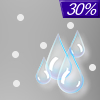
Today... A slight chance of rain between 1pm and 2pm, then a chance of rain and sleet. Cloudy, with a high near 37. North wind 6 to 8 mph becoming east in the afternoon. Chance of precipitation is 30%. Little or no sleet accumulation expected. |
|
|
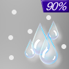
Tonight... Rain likely, possibly mixed with sleet before 11pm, then rain. Low around 33. East wind 6 to 9 mph. Chance of precipitation is 90%. Little or no sleet accumulation expected. |
|
|
Thursday... Rain before 1pm, then a chance of showers after 1pm. High near 51. East wind 8 to 15 mph becoming southwest in the afternoon. Winds could gust as high as 23 mph. Chance of precipitation is 90%. New precipitation amounts between a tenth and quarter of an inch possible. |
|
 |
Thursday Night... A chance of showers, mainly before 1am. Mostly cloudy, with a low around 44. Southwest wind 8 to 11 mph. Chance of precipitation is 30%. New precipitation amounts of less than a tenth of an inch possible. |
|
|
Friday... Mostly sunny, with a high near 54. Northwest wind 8 to 13 mph. |
|
 |
Friday Night... Partly cloudy, with a low around 28. |
|
|
Saturday... A chance of rain after 1pm. Increasing clouds, with a high near 39. Chance of precipitation is 50%. |
|
 |
Saturday Night... Rain likely. Mostly cloudy, with a low around 36. Chance of precipitation is 70%. |
|
|
Sunday... Cloudy, then gradually becoming mostly sunny, with a high near 58. |
|
|
Sunday Night... A chance of snow after 1am. Mostly cloudy, with a low around 29. Chance of precipitation is 30%. |
|
|
Monday... A chance of snow. Partly sunny, with a high near 41. Chance of precipitation is 30%. |
|
 |
Monday Night... A chance of rain and snow. Mostly cloudy, with a low around 30. Chance of precipitation is 30%. |
|
|
Tuesday... Rain and snow likely. Mostly cloudy, with a high near 42. Chance of precipitation is 70%. |
|
Current Radar Image
Sun Almanac for Oak Hill Estates, Maryland
Sunrise: 07:02 AM
Sunset: 5:29 PM
Civil Sunrise:06:34 AM
Civil Sunset: 5:56 PM
Nautical Sunrise: 06:03 AM
Nautical Sunset: 6:27 PM
Astro Sunrise: 05:32 AM
Astro Sunset: 6:58 PM
Maryland's Current Temperatures
 Maryland's Satellite Image
 Maryland's Current Wind Direction
| National Summary |
of upper and lower values of current conditions amongst 6984 locations
in the contiguous United States |
|
High
Temp |
75° |
Garden Banks172, Louisiana
and 1 other location
|
|
Low
Temp |
-17° |
Crane Lake, Minnesota
and 1 other location
|
|
Wind
Speed |
30mph |
Milford, Utah
and 1 other location
|
|
Wind
Gust |
47mph |
Milford, Utah
and 1 other location
|
|
Wind
Chill |
-23° |
Frenchville, Maine
|
|
High
Pressure |
30.49Hg |
Superior, Wisconsin
|
|
Low
Pressure |
29.35Hg |
Salmon, Idaho
|
|
| # Locations Reporting Snow |
62 |
|
| # Locations Reporting Rain |
33 |
|
| # Locations Reporting Fog |
94 |
|
| Average Temperature in the Contiguous USA |
34° |
|
Any use of the information on this page is at your own risk. This information should not be relied upon in life-threatening situations, potential financial loss situations or in lieu of any officially disseminated information. Visit the
National Weather Service for official information.


