Milton, Illinois Weather
your sport, your way
Air Sports Net on FacebookAir Sports Net on Google +Air Sports Net on TwitterReceive RSS UpdatesReceive Email Updates

Change location by the zip code or city,state: or search for other weather forecast locations in Illinois by name.
Weather Forecast for Milton, Illinois : Pike County
Issued: 2:06 am CST Feb 5, 2025 Latitude: 39.5644921 Longitude: -90.6504043 View on Google Maps

MouseOver for Detail Forecast
Overnight Wednesday Thursday Friday Saturday Sunday Monday Tuesday
Cloudy on Overnight 70% chance of freezing rain on Wednesday Mostly Cloudy on Thursday Mostly Sunny on Friday 70% chance of rain on Saturday Partly Sunny on Sunday Partly Sunny on Monday 30% chance of snow on Tuesday
Low: 28°F High: 36°F High: 48°F High: 40°F High: 45°F High: 35°F High: 37°F High: 32°F
Low: 36°F Low: 27°F Low: 33°F Low: 24°F Low: 21°F Low: 22°F  
Cloudy Freezing Rain Mostly Cloudy Mostly Sunny Rain Partly Sunny Partly Sunny Snow
-
Current Conditions at
PITTSFIELD - (KPPQ)
27°
Feels like 16°F
Cloudy
as of 4:35 AM CST
Rel. Humidity: 100%
Dew Point: 27°F
Visibility: 5 Miles
Pressure: 30.30 in.
Flight Rule: IFR
Wind Data
10 MPH
050° Northeast
Cloud Level(s): Solid Overcast at 800ft
Current Conditions at
JACKSONVILLE MUNICIPAL - (KIJX)
27°
Feels like 14°F
Cloudy
as of 4:35 AM CST
Rel. Humidity: 100%
Dew Point: 27°F
Visibility: 7 Miles
Pressure: 30.30 in.
Flight Rule: MVFR
Wind Data
15 MPH
060° Northeast
Cloud Level(s): Solid Overcast at 1000ft
Current Conditions at
QUINCY - (KUIN)
27°
Feels like 16°F
Cloudy
as of 4:01 AM CST
Rel. Humidity: 79%
Dew Point: 21°F
Visibility: 8 Miles
Pressure: 30.29 in.
Flight Rule: MVFR
Wind Data
12 MPH
060° Northeast
Cloud Level(s): Solid Overcast at 1400ft
Current Conditions at
ST CHARLES - (KSET)
32°
Feels like 23°F
Cloudy
as of 3:54 AM CST
Rel. Humidity: 74%
Dew Point: 25°F
Visibility: 10 Miles
Pressure: 30.28 in.
Flight Rule: VFR
Wind Data
12 MPH
050° Northeast
Cloud Level(s): Scattered at 1600ft, Solid Overcast at 3400ft
Cloudy on Overnight Overnight... Cloudy, with a low around 28. Northeast wind around 9 mph.

70% chance of freezing rain Wednesday 
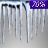
Wednesday... A chance of freezing rain before noon, then a chance of rain or freezing rain between noon and 2pm, then rain likely after 2pm. Patchy fog after 4pm. Otherwise, cloudy, with a high near 36. East wind around 9 mph. Chance of precipitation is 70%. Little or no ice accumulation expected.

80% chance of rain Wednesday Night Wednesday Night... Rain, mainly before 8pm. Patchy fog before 2am. Low around 36. Southeast wind 5 to 8 mph becoming west after midnight. Chance of precipitation is 80%.

Mostly Cloudy on Thursday Thursday... Mostly cloudy, then gradually becoming sunny, with a high near 48. Northwest wind 6 to 10 mph.

Mostly Clear on Thursday Night Thursday Night... Mostly clear, with a low around 27. Northwest wind around 5 mph becoming north after midnight.

Mostly Sunny on Friday Friday... Mostly sunny, with a high near 40.

50% chance of rain Friday Night Friday Night... A 50 percent chance of rain after midnight. Mostly cloudy, with a low around 33.

70% chance of rain Saturday Saturday... Rain likely, mainly before noon. Mostly cloudy, with a high near 45. Chance of precipitation is 70%.

Mostly Cloudy on Saturday Night Saturday Night... Mostly cloudy, with a low around 24.

Partly Sunny on Sunday Sunday... Partly sunny, with a high near 35.

Mostly Cloudy on Sunday Night Sunday Night... Mostly cloudy, with a low around 21.

Partly Sunny on Monday Monday... Partly sunny, with a high near 37.

40% chance of snow Monday Night Monday Night... A 40 percent chance of snow. Mostly cloudy, with a low around 22.

30% chance of snow Tuesday Tuesday... A 30 percent chance of snow. Mostly cloudy, with a high near 32.

Current Radar Image


Sun Almanac for Milton, Illinois
Sunrise: 07:06 AM
Sunset: 5:28 PM
Civil Sunrise:06:38 AM
Civil Sunset: 5:56 PM
Nautical Sunrise: 06:06 AM
Nautical Sunset: 6:28 PM
Astro Sunrise: 05:34 AM
Astro Sunset: 6:59 PM
Any use of the information on this page is at your own risk. This information should not be relied upon in life-threatening situations, potential financial loss situations or in lieu of any officially disseminated information. Visit the National Weather Service for official information.