Manor Oaks, Maryland Weather
|
|
|
|
|
|
|
|
 |
 |
 |
 |
 |
 |
 |
 |
| High: °F |
Low: °F |
High: °F |
High: °F |
High: °F |
High: °F |
High: °F |
High: °F |
| Low: °F |
Low: °F |
Low: °F |
Low: °F |
Low: °F |
|
| Snow & Sleet |
Freezing Rain & Snow |
Freezing Rain |
Sunny |
Freezing Rain & Snow |
Mostly Sunny |
Snow |
Snow |
Current Conditions at
CARROLL CNTY ARPT - (KDMW)
32°
Clear
as of 4:00 AM EST
Rel. Humidity: 54%
Dew Point: 18°F
Visibility: 10 Miles
Pressure: 30.29 in.
Flight Rule: VFR
Cloud Level(s): Clear
Current Conditions at
FORT MEADE - (KFME)
34°
Partly Cloudy
as of 4:09 AM EST
Rel. Humidity: 55%
Dew Point: 19°F
Visibility: 10 Miles
Pressure: 30.37 in.
Flight Rule: VFR
Cloud Level(s): Scattered at 12000ft
Current Conditions at
BALTIMORE INTL - (KBWI)
36°
Cloudy
as of 3:54 AM EST
Rel. Humidity: 43%
Dew Point: 16°F
Visibility: 10 Miles
Pressure: 30.32 in.
Flight Rule: VFR
Cloud Level(s): Few at 9000ft, Solid Overcast at 12000ft
Current Conditions at
WASHINGTON - (KDCA)
39°
Cloudy
as of 3:52 AM EST
Rel. Humidity: 41%
Dew Point: 18°F
Visibility: 10 Miles
Pressure: 30.34 in.
Flight Rule: VFR
Cloud Level(s): Broken at 13000ft, Solid Overcast at 25000ft
|
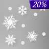
Today... A slight chance of snow between 1pm and 3pm, then a slight chance of sleet after 3pm. Cloudy, with a high near 36. North wind around 5 mph becoming light and variable in the afternoon. Chance of precipitation is 20%. |
|
|
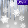
Tonight... Snow and sleet likely before 1am, then freezing rain, possibly mixed with sleet. Low around 30. Southeast wind 6 to 8 mph. Chance of precipitation is 100%. New ice accumulation of around a 0.1 of an inch possible. New snow and sleet accumulation of less than a half inch possible. |
|
|
Thursday... Rain and freezing rain, possibly mixed with sleet, becoming all rain after 10am, then gradually ending. High near 48. Southeast wind 7 to 9 mph becoming southwest in the afternoon. Chance of precipitation is 90%. New ice accumulation of less than a 0.1 of an inch possible. New sleet accumulation of less than a half inch possible. |
|
 |
Thursday Night... A chance of rain between 7pm and 1am. Mostly cloudy, with a low around 38. Southwest wind 6 to 9 mph becoming west after midnight. Chance of precipitation is 30%. |
|
|
Friday... Sunny, with a high near 47. Northwest wind 10 to 13 mph, with gusts as high as 21 mph. |
|
 |
Friday Night... A slight chance of snow after 1am. Mostly cloudy, with a low around 26. Chance of precipitation is 20%. |
|
|
Saturday... A chance of snow and sleet before 1pm, then snow, freezing rain, and sleet. High near 34. Chance of precipitation is 80%. |
|
 |
Saturday Night... Rain likely, mainly before 1am. Mostly cloudy, with a low around 32. Chance of precipitation is 60%. |
|
|
Sunday... Mostly sunny, with a high near 48. |
|
 |
Sunday Night... Partly cloudy, with a low around 27. |
|
|
Monday... A chance of snow. Partly sunny, with a high near 36. Chance of precipitation is 30%. |
|
 |
Monday Night... A chance of snow. Mostly cloudy, with a low around 27. Chance of precipitation is 40%. |
|
|
Tuesday... Snow. High near 35. Chance of precipitation is 80%. |
|
Current Radar Image
Sun Almanac for Manor Oaks, Maryland
Sunrise: 07:11 AM
Sunset: 5:34 PM
Civil Sunrise:06:43 AM
Civil Sunset: 6:02 PM
Nautical Sunrise: 06:11 AM
Nautical Sunset: 6:34 PM
Astro Sunrise: 05:40 AM
Astro Sunset: 7:05 PM
Maryland's Current Temperatures
 Maryland's Satellite Image
 Maryland's Current Wind Direction
| National Summary |
of upper and lower values of current conditions amongst 6952 locations
in the contiguous United States |
|
High
Temp |
77° |
Keathley C 875, Louisiana
|
|
Low
Temp |
-17° |
Crane Lake, Minnesota
|
|
Wind
Speed |
32mph |
Salt Lake Municipal, Utah
|
|
Wind
Gust |
59mph |
Pocatello, Idaho
|
|
Wind
Chill |
-22° |
Frenchville, Maine
|
|
High
Pressure |
30.51Hg |
Superior, Wisconsin
|
|
Low
Pressure |
29.35Hg |
Mullan Pass, Idaho
|
|
| # Locations Reporting Snow |
56 |
|
| # Locations Reporting Rain |
23 |
|
| # Locations Reporting Fog |
91 |
|
| Average Temperature in the Contiguous USA |
34° |
|
Any use of the information on this page is at your own risk. This information should not be relied upon in life-threatening situations, potential financial loss situations or in lieu of any officially disseminated information. Visit the
National Weather Service for official information.


