Maple Grove, New York Weather
Issued: 9:39 am EST Feb 5, 2025 Latitude: 43.2561825 Longitude: -74.1537431 View on Google Maps
|
|
|
|
|
|
|
|
|
|
 |
 |
 |
 |
 |
 |
|
 |
| High: °F |
Low: °F |
High: °F |
High: °F |
High: °F |
High: °F |
High: °F |
High: °F |
| Low: °F |
Low: °F |
Low: °F |
Low: °F |
Low: °F |
|
| Sunny |
Mostly Cloudy |
Freezing Rain & Snow |
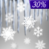
Snow |
Partly Sunny |
Snow |
Partly Sunny |
Mostly Cloudy |
Current Conditions at
GLENS FALLS - (KGFL)
10°
Clear
as of 8:53 AM EST
Rel. Humidity: 66%
Dew Point: 1°F
Visibility: 10 Miles
Pressure: 30.43 in.
Flight Rule: VFR
Wind Data
3 MPH
130° Southeast
Cloud Level(s): Clear
Current Conditions at
ALBANY - (KALB)
Mostly Clear
as of 8:51 AM EST
Rel. Humidity: 52%
Dew Point: 1°F
Visibility: 10 Miles
Pressure: 30.45 in.
Flight Rule: VFR
Cloud Level(s): Few at 3500ft, Few at 15000ft, Few at 25000ft
Current Conditions at
BENNINGTON - (KDDH)
10°
Clear
as of 8:54 AM EST
Rel. Humidity: 60%
Dew Point: -0°F
Visibility: 10 Miles
Pressure: 30.38 in.
Flight Rule: VFR
Cloud Level(s): Clear
|
Today... Sunny, with a high near 18. Wind chill values as low as -4. West wind around 7 mph. |
|
|
Tonight... Mostly cloudy, with a low around 3. West wind around 5 mph becoming calm in the evening. |
|
|
Thursday... Snow, possibly mixed with sleet before 2pm, then snow likely, possibly mixed with freezing rain and sleet between 2pm and 3pm, then snow and freezing rain likely after 3pm. The snow could be heavy at times. High near 26. Southeast wind 3 to 7 mph. Chance of precipitation is 100%. New ice accumulation of less than a 0.1 of an inch possible. New snow and sleet accumulation of 3 to 5 inches possible. |
|
 |
Thursday Night... A chance of freezing rain before 10pm, then a chance of snow showers. Mostly cloudy, with a low around 20. Breezy, with a west wind 6 to 11 mph increasing to 16 to 21 mph after midnight. Chance of precipitation is 30%. New snow accumulation of less than a half inch possible. |
|
|
Friday... A slight chance of snow showers. Mostly cloudy, with a high near 24. Breezy, with a west wind 17 to 21 mph, with gusts as high as 32 mph. Chance of precipitation is 20%. |
|
|
Friday Night... Mostly cloudy, with a low around 13. |
|
|
Saturday... Partly sunny, with a high near 26. |
|
 |
Saturday Night... Snow. Low around 16. Chance of precipitation is 90%. |
|
|
Sunday... A chance of snow before 1pm. Mostly cloudy, with a high near 30. Chance of precipitation is 50%. |
|
 |
Sunday Night... Partly cloudy, with a low around 6. |
|
|
Monday... Partly sunny, with a high near 25. |
|
|
Monday Night... Partly cloudy, with a low around 5. |
|
|
Tuesday... Mostly cloudy, with a high near 24. |
|
Current Radar Image
Sun Almanac for Maple Grove, New York
Sunrise: 07:07 AM
Sunset: 5:14 PM
Civil Sunrise:06:37 AM
Civil Sunset: 5:44 PM
Nautical Sunrise: 06:03 AM
Nautical Sunset: 6:18 PM
Astro Sunrise: 05:30 AM
Astro Sunset: 6:51 PM
New York's Current Temperatures
 New York's Satellite Image
 New York's Current Wind Direction
| National Summary |
of upper and lower values of current conditions amongst 7111 locations
in the contiguous United States |
|
High
Temp |
79° |
Keathley C 875, Louisiana
|
|
Low
Temp |
-13° |
Foxtrot, Montana
|
|
Wind
Speed |
33mph |
Elk Mountain, Wyoming
|
|
Wind
Gust |
47mph |
Salmon, Idaho
|
|
Wind
Chill |
-31° |
Cutbank, Montana
|
|
High
Pressure |
30.51Hg |
Massena, New York
|
|
Low
Pressure |
29.48Hg |
Mullan Pass, Idaho
and 1 other location
|
|
| # Locations Reporting Snow |
56 |
|
| # Locations Reporting Rain |
42 |
|
| # Locations Reporting Fog |
84 |
|
| Average Temperature in the Contiguous USA |
35° |
|
Any use of the information on this page is at your own risk. This information should not be relied upon in life-threatening situations, potential financial loss situations or in lieu of any officially disseminated information. Visit the
National Weather Service for official information.


