Midway, Illinois Weather
your sport, your way
Air Sports Net on FacebookAir Sports Net on Google +Air Sports Net on TwitterReceive RSS UpdatesReceive Email Updates

Change location by the zip code or city,state: or search for other weather forecast locations in Illinois by name.
Weather Forecast for Midway, Illinois : Fulton County
Issued: 4:42 am CST Feb 5, 2025 Latitude: 40.6986502 Longitude: -90.2434569 View on Google Maps

MouseOver for Detail Forecast
Today Tonight Thursday Friday Saturday Sunday Monday Tuesday
70% chance of freezing rain on Today 80% chance of freezing rain on Tonight Clearing on Thursday Partly Sunny on Friday 80% chance of freezing rain & snow on Saturday Mostly Sunny on Sunday Partly Sunny on Monday Partly Sunny on Tuesday
High: 33°F Low: 31°F High: 44°F High: 38°F High: 38°F High: 33°F High: 36°F High: 30°F
Low: 22°F Low: 28°F Low: 20°F Low: 17°F Low: 17°F  
Freezing Rain Freezing Rain Clearing Partly Sunny Freezing Rain & Snow Mostly Sunny Partly Sunny Partly Sunny
-
Current Conditions at
GALESBURG - (KGBG)
25°
Feels like 14°F
Cloudy
as of 4:15 AM CST
Rel. Humidity: 85%
Dew Point: 21°F
Visibility: 10 Miles
Pressure: 30.35 in.
Flight Rule: MVFR
Wind Data
10 MPH
070° East
Cloud Level(s): Solid Overcast at 1800ft
Current Conditions at
MACOMB MUNICIPAL AIRPORT - (KMQB)
25°
Feels like 12°F
Cloudy
as of 4:15 AM CST
Rel. Humidity: 85%
Dew Point: 21°F
Visibility: 10 Miles
Pressure: 30.34 in.
Flight Rule: MVFR
Wind Data
14 MPH
070° East
Cloud Level(s): Broken at 1600ft, Solid Overcast at 4500ft
Current Conditions at
PEORIA - (KPIA)
27°
Feels like 16°F
Cloudy
as of 4:03 AM CST
Rel. Humidity: 73%
Dew Point: 19°F
Visibility: 10 Miles
Pressure: 30.34 in.
Flight Rule: VFR
Wind Data
12 MPH
060° Northeast
Cloud Level(s): Scattered at 1600ft, Solid Overcast at 5500ft
Current Conditions at
BURLINGTON - (KBRL)
25°
Feels like 13°F
Cloudy
as of 3:53 AM CST
Rel. Humidity: 73%
Dew Point: 18°F
Visibility: 10 Miles
Pressure: 30.32 in.
Flight Rule: VFR
Wind Data
13 MPH
080° East
Cloud Level(s): Solid Overcast at 4900ft
70% chance of freezing rain Today 
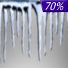
Today... Freezing rain likely, mainly after 3pm. Cloudy, with a high near 33. East southeast wind 8 to 15 mph, with gusts as high as 20 mph. Chance of precipitation is 70%. Little or no ice accumulation expected.

80% chance of freezing rain Tonight 
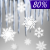
Tonight... Freezing rain, mainly before 9pm. Low around 31. East southeast wind 5 to 8 mph becoming calm. Winds could gust as high as 18 mph. Chance of precipitation is 80%. New ice accumulation of less than a 0.1 of an inch possible.

Clearing on Thursday Thursday... Cloudy through mid morning, then gradual clearing, with a high near 44. West northwest wind 6 to 14 mph, with gusts as high as 22 mph.

Cloudy on Thursday Night Thursday Night... Partly cloudy, with a low around 22. West wind 3 to 7 mph. Winds could gust as high as 16 mph.

Partly Sunny on Friday Friday... Partly sunny, with a high near 38. Light and variable wind.

30% chance of freezing rain & snow Friday Night 
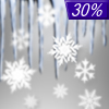
Friday Night... A chance of snow after midnight, mixing with freezing rain after 3am. Mostly cloudy, with a low around 28. East wind 3 to 8 mph. Winds could gust as high as 20 mph. Chance of precipitation is 30%.

80% chance of freezing rain & snow Saturday Saturday... Rain or freezing rain before noon, then rain and snow likely. High near 38. East wind around 10 mph becoming north northwest in the afternoon. Winds could gust as high as 20 mph. Chance of precipitation is 80%. New precipitation amounts between a tenth and quarter of an inch possible.

Mostly Cloudy on Saturday Night Saturday Night... Mostly cloudy, with a low around 20.

Mostly Sunny on Sunday Sunday... Mostly sunny, with a high near 33.

Cloudy on Sunday Night Sunday Night... Partly cloudy, with a low around 17.

Partly Sunny on Monday Monday... Partly sunny, with a high near 36.

Mostly Cloudy on Monday Night Monday Night... Mostly cloudy, with a low around 17.

Partly Sunny on Tuesday Tuesday... Partly sunny, with a high near 30.

Current Radar Image


Sun Almanac for Midway, Illinois
Sunrise: 07:06 AM
Sunset: 5:24 PM
Civil Sunrise:06:38 AM
Civil Sunset: 5:52 PM
Nautical Sunrise: 06:05 AM
Nautical Sunset: 6:25 PM
Astro Sunrise: 05:33 AM
Astro Sunset: 6:57 PM
Any use of the information on this page is at your own risk. This information should not be relied upon in life-threatening situations, potential financial loss situations or in lieu of any officially disseminated information. Visit the National Weather Service for official information.