Derby, Illinois Weather
your sport, your way
Air Sports Net on FacebookAir Sports Net on Google +Air Sports Net on TwitterReceive RSS UpdatesReceive Email Updates

Change location by the zip code or city,state: or search for other weather forecast locations in Illinois by name.
Weather Forecast for Derby, Illinois : Ford County
Issued: 4:27 am CST Feb 5, 2025 Latitude: 40.4417005 Longitude: -88.4425568 View on Google Maps

MouseOver for Detail Forecast
Today Tonight Thursday Friday Saturday Sunday Monday Tuesday
40% chance of freezing rain on Today 90% chance of freezing rain on Tonight Mostly Cloudy on Thursday Partly Sunny on Friday 90% chance of freezing rain & snow on Saturday Partly Sunny on Sunday Partly Sunny on Monday 20% chance of snow on Tuesday
High: 34°F Low: 36 °F High: 45°F High: 36°F High: 37°F High: 33°F High: 35°F High: 30°F
Low: 23°F Low: 28°F Low: 22°F Low: 18°F Low: 20°F  
Freezing Rain Freezing Rain Mostly Cloudy Partly Sunny Freezing Rain & Snow Partly Sunny Partly Sunny Snow
-
Current Conditions at
RANTOUL - (KTIP)
27°
Feels like 16°F
Cloudy
as of 4:35 AM CST
Rel. Humidity: 73%
Dew Point: 19°F
Visibility: 10 Miles
Pressure: 30.33 in.
Flight Rule: VFR
Wind Data
10 MPH
060° Northeast
Cloud Level(s): Solid Overcast at 5000ft
Current Conditions at
BLOOMINGTON - (KBMI)
27°
Feels like 14°F
Cloudy
as of 3:56 AM CST
Rel. Humidity: 79%
Dew Point: 21°F
Visibility: 10 Miles
Pressure: 30.34 in.
Flight Rule: VFR
Wind Data
15 MPH
060° Northeast
Cloud Level(s): Solid Overcast at 5500ft
Current Conditions at
CHAMPAIGN - (KCMI)
28°
Feels like 17°F
Cloudy
as of 3:53 AM CST
Rel. Humidity: 68%
Dew Point: 19°F
Visibility: 10 Miles
Pressure: 30.32 in.
Flight Rule: VFR
Wind Data
15 MPH
050° Northeast
Cloud Level(s): Solid Overcast at 4400ft
Current Conditions at
PONTIAC MUNICIPAL AIRPT - (KPNT)
27°
Feels like 14°F
Cloudy
as of 4:35 AM CST
Rel. Humidity: 79%
Dew Point: 21°F
Visibility: 10 Miles
Pressure: 30.36 in.
Flight Rule: VFR
Wind Data
15 MPH
060° Northeast
Cloud Level(s): Solid Overcast at 6000ft
40% chance of freezing rain Today 
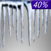
Today... A slight chance of drizzle before 4pm, then a slight chance of drizzle or freezing rain between 4pm and 5pm, then a chance of freezing rain after 5pm. Cloudy, with a high near 34. East wind 10 to 15 mph, with gusts as high as 20 mph. Chance of precipitation is 40%.

90% chance of freezing rain Tonight Tonight... Freezing rain before midnight, then a chance of drizzle between midnight and 3am. Temperature rising to around 36 by 3am. East southeast wind around 10 mph becoming west after midnight. Winds could gust as high as 20 mph. Chance of precipitation is 90%. New ice accumulation of less than a 0.1 of an inch possible.

Mostly Cloudy on Thursday Thursday... Mostly cloudy, then gradually becoming sunny, with a high near 45. West wind 10 to 15 mph, with gusts as high as 25 mph.

Cloudy on Thursday Night Thursday Night... Partly cloudy, with a low around 23. West wind 10 to 15 mph.

Partly Sunny on Friday Friday... Partly sunny, with a high near 36. North northwest wind around 5 mph becoming northeast in the afternoon. Winds could gust as high as 10 mph.

30% chance of snow Friday Night Friday Night... A 30 percent chance of snow after 3am. Mostly cloudy, with a low around 28.

90% chance of freezing rain & snow Saturday Saturday... Rain, snow, freezing rain, and sleet likely before noon, then rain, possibly mixed with snow. High near 37. Chance of precipitation is 90%.

Mostly Cloudy on Saturday Night Saturday Night... Mostly cloudy, with a low around 22.

Partly Sunny on Sunday Sunday... Partly sunny, with a high near 33.

Cloudy on Sunday Night Sunday Night... Partly cloudy, with a low around 18.

Partly Sunny on Monday Monday... Partly sunny, with a high near 35.

Mostly Cloudy on Monday Night Monday Night... Mostly cloudy, with a low around 20.

20% chance of snow Tuesday Tuesday... A chance of snow. Partly sunny, with a high near 30.

Current Radar Image


Sun Almanac for Derby, Illinois
Sunrise: 06:58 AM
Sunset: 5:17 PM
Civil Sunrise:06:30 AM
Civil Sunset: 5:46 PM
Nautical Sunrise: 05:58 AM
Nautical Sunset: 6:18 PM
Astro Sunrise: 05:26 AM
Astro Sunset: 6:50 PM
Any use of the information on this page is at your own risk. This information should not be relied upon in life-threatening situations, potential financial loss situations or in lieu of any officially disseminated information. Visit the National Weather Service for official information.