Zoar, New York Weather
your sport, your way
Air Sports Net on FacebookAir Sports Net on Google +Air Sports Net on TwitterReceive RSS UpdatesReceive Email Updates

Change location by the zip code or city,state: or search for other weather forecast locations in New York by name.
Weather Forecast for Zoar, New York : Erie County
Issued: 9:41 am EST Feb 5, 2025 Latitude: 42.4567283 Longitude: -78.8391986 View on Google Maps

MouseOver for Detail Forecast
Today Tonight Thursday Friday Saturday Sunday Monday Tuesday
Mostly Cloudy on Today 80% chance of snow on Tonight 80% chance of freezing rain & snow on Thursday 20% chance of snow on Friday 60% chance of snow on Saturday 40% chance of snow on Sunday Mostly Cloudy on Monday Mostly Cloudy on Tuesday
High: 24°F Low: 29 °F High: 40°F High: 22°F High: 32°F High: 28°F High: 27°F High: 25°F
Low: 18°F Low: 12°F Low: 22°F Low: 15°F Low: 12°F  
Mostly Cloudy Snow Freezing Rain & Snow Snow Snow Snow Mostly Cloudy Mostly Cloudy
-
Current Conditions at
DUNKIRK - (KDKK)
21°
Partly Cloudy
as of 8:53 AM EST
Rel. Humidity: 67%
Dew Point: 12°F
Visibility: 10 Miles
Pressure: 30.46 in.
Flight Rule: VFR
Wind Data
5 MPH
170° South
Cloud Level(s): Scattered at 3400ft
Current Conditions at
JAMESTOWN - (KJHW)
19°
Partly Cloudy
as of 9:19 AM EST
Rel. Humidity: 62%
Dew Point: 9°F
Visibility: 10 Miles
Pressure: 30.37 in.
Flight Rule: VFR
Wind Data
Calm
Cloud Level(s): Scattered at 2000ft
Current Conditions at
BUFFALO - (KBUF)
19°
Cloudy
Light Snow
as of 8:54 AM EST
Rel. Humidity: 67%
Dew Point: 10°F
Visibility: 10 Miles
Pressure: 30.44 in.
Flight Rule: MVFR
Wind Data
7 MPH
240° Southwest
Cloud Level(s): Broken at 2300ft, Solid Overcast at 3300ft
Current Conditions at
NIAGARA FALLS - (KIAG)
21°
Cloudy
Light Snow
as of 9:22 AM EST
Rel. Humidity: 38%
Visibility: 5 Miles
Pressure: 30.45 in.
Flight Rule: MVFR
Wind Data
7 MPH
230° Southwest
Cloud Level(s): Broken at 2100ft, Solid Overcast at 3200ft
Mostly Cloudy on Today Today... Mostly cloudy, with a high near 24. Southeast wind around 5 mph becoming calm in the afternoon.

80% chance of snow Tonight 
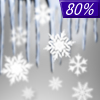
Tonight... Snow, mainly after 4am. Temperature rising to around 29 by 5am. Breezy, with a southeast wind 8 to 13 mph increasing to 15 to 20 mph after midnight. Chance of precipitation is 80%. New snow accumulation of less than a half inch possible.

80% chance of freezing rain & snow Thursday Thursday... Snow and sleet before 8am, then freezing rain and sleet likely between 8am and 9am, then rain likely after 9am. High near 40. Breezy, with a south wind 17 to 22 mph becoming west in the afternoon. Chance of precipitation is 80%. Little or no ice accumulation expected. New snow and sleet accumulation of less than a half inch possible.

20% chance of rain & snow Thursday Night Thursday Night... A slight chance of rain and snow showers before 8pm, then a slight chance of snow showers after 3am. Mostly cloudy, with a low around 18. Breezy, with a west wind 20 to 25 mph. Chance of precipitation is 20%.

20% chance of snow Friday Friday... A slight chance of snow showers before 11am. Mostly cloudy, with a high near 22. West wind 13 to 17 mph, with gusts as high as 30 mph. Chance of precipitation is 20%.

Mostly Cloudy on Friday Night Friday Night... Mostly cloudy, with a low around 12. West wind 5 to 9 mph becoming light after midnight.

60% chance of snow Saturday Saturday... Snow likely after 1pm. Mostly cloudy, with a high near 32. Calm wind becoming southeast around 6 mph in the afternoon. Chance of precipitation is 60%.

100% chance of snow Saturday Night Saturday Night... Snow. Low around 22. Southeast wind 5 to 8 mph becoming southwest after midnight. Chance of precipitation is 100%.

40% chance of snow Sunday Sunday... A chance of snow showers. Mostly cloudy, with a high near 28. Chance of precipitation is 40%.

Mostly Cloudy on Sunday Night Sunday Night... Mostly cloudy, with a low around 15.

Mostly Cloudy on Monday Monday... Mostly cloudy, with a high near 27.

Mostly Cloudy on Monday Night Monday Night... Mostly cloudy, with a low around 12.

Mostly Cloudy on Tuesday Tuesday... Mostly cloudy, with a high near 25.

Current Radar Image


Sun Almanac for Zoar, New York
Sunrise: 07:24 AM
Sunset: 5:35 PM
Civil Sunrise:06:55 AM
Civil Sunset: 6:04 PM
Nautical Sunrise: 06:21 AM
Nautical Sunset: 6:38 PM
Astro Sunrise: 05:48 AM
Astro Sunset: 7:10 PM
Any use of the information on this page is at your own risk. This information should not be relied upon in life-threatening situations, potential financial loss situations or in lieu of any officially disseminated information. Visit the National Weather Service for official information.