
| your sport, your way | ||||
 |  |  |  |  |
|

| This Afternoon | Tonight | Thursday | Friday | Saturday | Sunday | Monday | Tuesday |
 |
 |
 |
 |
 |
 |
 |
 |
| High: 40°F | Low: 33°F | High: 58°F | High: 61°F | High: 44°F | High: 58°F | High: 40°F | High: 39°F |
| Low: 41°F | Low: 33°F | Low: 38°F | Low: 31°F | Low: 32°F | |||
| Rain | Freezing Rain | Freezing Rain | Sunny | Rain & Snow | Mostly Sunny | Snow | Rain & Snow |


|
This Afternoon... A slight chance of sleet after 1pm, mixing with rain after 5pm. Cloudy, with a high near 40. Northeast wind around 5 mph becoming calm. Chance of precipitation is 20%. |
|
Tonight... Rain likely before midnight, then sleet, possibly mixed with freezing rain. Low around 33. Calm wind. Chance of precipitation is 90%. Little or no ice accumulation expected. New sleet accumulation of less than a half inch possible. |
|
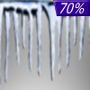
Thursday... Sleet likely, possibly mixed with freezing rain before 8am, then rain likely. Cloudy, then gradually becoming mostly sunny, with a high near 58. Light southwest wind increasing to 5 to 10 mph in the morning. Winds could gust as high as 21 mph. Chance of precipitation is 70%. Little or no ice accumulation expected. New sleet accumulation of less than a half inch possible. |
 |
Thursday Night... A slight chance of rain before 1am. Mostly cloudy, with a low around 41. Southwest wind around 6 mph becoming light and variable after midnight. Chance of precipitation is 20%. |
|
Friday... Sunny, with a high near 61. West wind 3 to 6 mph. |
 |
Friday Night... A slight chance of rain after 1am, mixing with snow after 4am. Partly cloudy, with a low around 33. Chance of precipitation is 20%. |
|
Saturday... Rain likely before 7am, then rain and snow likely between 7am and 1pm, then rain likely after 1pm. Mostly cloudy, with a high near 44. Chance of precipitation is 60%. |
 |
Saturday Night... A chance of rain before 1am. Mostly cloudy, with a low around 38. Chance of precipitation is 40%. |
|
Sunday... Mostly sunny, with a high near 58. |
 |
Sunday Night... Mostly cloudy, with a low around 31. |
|
Monday... A chance of snow. Mostly cloudy, with a high near 40. Chance of precipitation is 50%. |
 |
Monday Night... Rain and snow likely. Cloudy, with a low around 32. Chance of precipitation is 70%. |
|
Tuesday... Rain and snow. High near 39. Chance of precipitation is 80%. |


