Southern View, Illinois Weather
Issued: 2:06 am CST Feb 5, 2025 Latitude: 39.9044903 Longitude: -91.3982056 View on Google Maps
|
|
|
|
|
|
|
|
|
|
 |
 |
 |
 |
 |
|
|
 |
| Low: °F |
High: °F |
High: °F |
High: °F |
High: °F |
High: °F |
High: °F |
High: °F |
| Low: °F |
Low: °F |
Low: °F |
Low: °F |
Low: °F |
Low: °F |
|
| Cloudy |
Freezing Rain |
Clearing |
Partly Sunny |
Rain |
Partly Sunny |
Partly Sunny |
Snow |
Current Conditions at
QUINCY - (KUIN)
Cloudy
as of 2:54 AM CST
Rel. Humidity: 74%
Dew Point: 21°F
Visibility: 10 Miles
Pressure: 30.31 in.
Flight Rule: MVFR
Cloud Level(s): Solid Overcast at 2100ft
Current Conditions at
PITTSFIELD - (KPPQ)
Cloudy
as of 3:35 AM CST
Rel. Humidity: 86%
Dew Point: 25°F
Visibility: 7 Miles
Pressure: 30.31 in.
Flight Rule: MVFR
Wind Data
9 MPH
Gust: 18 MPH
050° Northeast
Cloud Level(s): Solid Overcast at 1200ft
Current Conditions at
KEOKUK MUNICIPAL - (KEOK)
Cloudy
as of 3:35 AM CST
Rel. Humidity: 85%
Dew Point: 21°F
Visibility: 10 Miles
Pressure: 30.32 in.
Flight Rule: VFR
Wind Data
13 MPH
Gust: 21 MPH
060° Northeast
Cloud Level(s): Solid Overcast at 3600ft
Current Conditions at
FORT MADISON - (KFSW)
Cloudy
as of 3:35 AM CST
Rel. Humidity: 73%
Dew Point: 18°F
Visibility: 10 Miles
Pressure: 30.32 in.
Flight Rule: VFR
Wind Data
13 MPH
040° Northeast
Cloud Level(s): Scattered at 3300ft, Solid Overcast at 4400ft
|
Overnight... Cloudy, with a low around 28. East wind around 9 mph. |
|
|
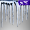
Wednesday... A chance of freezing rain between 7am and 2pm, then rain likely. Patchy fog after 5pm. Otherwise, cloudy, with a high near 35. East wind 7 to 9 mph. Chance of precipitation is 60%. Little or no ice accumulation expected. |
|
 |
Wednesday Night... Rain likely, mainly before 10pm. Patchy fog before 2am. Otherwise, cloudy, with a low around 35. Southeast wind around 6 mph becoming calm. Chance of precipitation is 60%. |
|
|
Thursday... Mostly cloudy through mid morning, then gradual clearing, with a high near 48. Northwest wind 6 to 9 mph. |
|
 |
Thursday Night... Mostly clear, with a low around 27. Northwest wind around 5 mph becoming light and variable in the evening. |
|
|
Friday... Partly sunny, with a high near 41. |
|
 |
Friday Night... A 40 percent chance of rain after midnight. Mostly cloudy, with a low around 33. |
|
|
Saturday... Rain likely, mainly before noon. Mostly cloudy, with a high near 42. Chance of precipitation is 70%. |
|
 |
Saturday Night... Mostly cloudy, with a low around 23. |
|
|
Sunday... Partly sunny, with a high near 35. |
|
|
Sunday Night... Mostly cloudy, with a low around 21. |
|
|
Monday... Partly sunny, with a high near 38. |
|
 |
Monday Night... A 30 percent chance of snow. Mostly cloudy, with a low around 22. |
|
|
Tuesday... A 20 percent chance of snow. Partly sunny, with a high near 32. |
|
Current Radar Image
Sun Almanac for Southern View, Illinois
Sunrise: 07:09 AM
Sunset: 5:30 PM
Civil Sunrise:06:41 AM
Civil Sunset: 5:58 PM
Nautical Sunrise: 06:09 AM
Nautical Sunset: 6:30 PM
Astro Sunrise: 05:37 AM
Astro Sunset: 7:02 PM
Illinois' Current Temperatures
 Illinois' Satellite Image
 Illinois' Current Wind Direction
| National Summary |
of upper and lower values of current conditions amongst 6973 locations
in the contiguous United States |
|
High
Temp |
77° |
Keathley C 875, Louisiana
|
|
Low
Temp |
-17° |
Crane Lake, Minnesota
|
|
Wind
Speed |
31mph |
Cedar City, Utah
|
|
Wind
Gust |
59mph |
Pocatello, Idaho
|
|
Wind
Chill |
-22° |
Frenchville, Maine
|
|
High
Pressure |
30.51Hg |
Superior, Wisconsin
|
|
Low
Pressure |
29.34Hg |
Mullan Pass, Idaho
|
|
| # Locations Reporting Snow |
58 |
|
| # Locations Reporting Rain |
25 |
|
| # Locations Reporting Thunderstorms / Lightning |
1 |
|
| # Locations Reporting Fog |
94 |
|
| Average Temperature in the Contiguous USA |
34° |
|
Any use of the information on this page is at your own risk. This information should not be relied upon in life-threatening situations, potential financial loss situations or in lieu of any officially disseminated information. Visit the
National Weather Service for official information.


