Meyer, Illinois Weather
your sport, your way
Air Sports Net on FacebookAir Sports Net on Google +Air Sports Net on TwitterReceive RSS UpdatesReceive Email Updates

Change location by the zip code or city,state: or search for other weather forecast locations in Illinois by name.
Weather Forecast for Meyer, Illinois : Adams County
Issued: 2:06 am CST Feb 5, 2025 Latitude: 40.1478233 Longitude: -91.5034884 View on Google Maps

MouseOver for Detail Forecast
Overnight Wednesday Thursday Friday Saturday Sunday Monday Tuesday
Cloudy on Overnight 60% chance of freezing rain on Wednesday Mostly Sunny on Thursday Partly Sunny on Friday 70% chance of rain on Saturday Mostly Sunny on Sunday Partly Sunny on Monday 20% chance of snow on Tuesday
Low: 27°F High: 34°F High: 46°F High: 39°F High: 40°F High: 34°F High: 36°F High: 30°F
Low: 34°F Low: 25°F Low: 32°F Low: 22°F Low: 19°F Low: 20°F  
Cloudy Freezing Rain Mostly Sunny Partly Sunny Rain Mostly Sunny Partly Sunny Snow
-
Current Conditions at
QUINCY - (KUIN)
28°
Feels like 17°F
Cloudy
as of 2:54 AM CST
Rel. Humidity: 74%
Dew Point: 21°F
Visibility: 10 Miles
Pressure: 30.31 in.
Flight Rule: MVFR
Wind Data
14 MPH
070° East
Cloud Level(s): Solid Overcast at 2100ft
Current Conditions at
KEOKUK MUNICIPAL - (KEOK)
25°
Feels like 13°F
Cloudy
as of 3:35 AM CST
Rel. Humidity: 85%
Dew Point: 21°F
Visibility: 10 Miles
Pressure: 30.32 in.
Flight Rule: VFR
Wind Data
13 MPH
Gust: 21 MPH
060° Northeast
Cloud Level(s): Solid Overcast at 3600ft
Current Conditions at
FORT MADISON - (KFSW)
25°
Feels like 13°F
Cloudy
as of 3:35 AM CST
Rel. Humidity: 73%
Dew Point: 18°F
Visibility: 10 Miles
Pressure: 30.32 in.
Flight Rule: VFR
Wind Data
13 MPH
040° Northeast
Cloud Level(s): Scattered at 3300ft, Solid Overcast at 4400ft
Current Conditions at
BURLINGTON - (KBRL)
25°
Feels like 12°F
Cloudy
as of 2:53 AM CST
Rel. Humidity: 73%
Dew Point: 18°F
Visibility: 10 Miles
Pressure: 30.35 in.
Flight Rule: VFR
Wind Data
14 MPH
080° East
Cloud Level(s): Solid Overcast at 5000ft
Cloudy on Overnight Overnight... Cloudy, with a low around 27. East wind around 9 mph.

60% chance of freezing rain Wednesday 
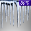
Wednesday... A chance of freezing rain before 2pm, then a chance of rain or freezing rain between 2pm and 4pm, then rain likely after 4pm. Cloudy, with a high near 34. East wind 6 to 9 mph. Chance of precipitation is 60%. New ice accumulation of less than a 0.1 of an inch possible.

50% chance of rain Wednesday Night Wednesday Night... A 50 percent chance of rain, mainly before 10pm. Patchy fog before 2am. Otherwise, cloudy, with a low around 34. Southeast wind around 6 mph becoming calm.

Mostly Sunny on Thursday Thursday... Mostly sunny, with a high near 46. Northwest wind 6 to 10 mph.

Mostly Clear on Thursday Night Thursday Night... Mostly clear, with a low around 25. West wind around 5 mph becoming light and variable in the evening.

Partly Sunny on Friday Friday... Partly sunny, with a high near 39.

30% chance of rain Friday Night Friday Night... A 30 percent chance of rain after midnight. Mostly cloudy, with a low around 32.

70% chance of rain Saturday Saturday... Rain likely, mainly before noon. Mostly cloudy, with a high near 40. Chance of precipitation is 70%.

Mostly Cloudy on Saturday Night Saturday Night... Mostly cloudy, with a low around 22.

Mostly Sunny on Sunday Sunday... Mostly sunny, with a high near 34.

Cloudy on Sunday Night Sunday Night... Partly cloudy, with a low around 19.

Partly Sunny on Monday Monday... Partly sunny, with a high near 36.

30% chance of snow Monday Night Monday Night... A 30 percent chance of snow. Mostly cloudy, with a low around 20.

20% chance of snow Tuesday Tuesday... A 20 percent chance of snow. Partly sunny, with a high near 30.

Current Radar Image


Sun Almanac for Meyer, Illinois
Sunrise: 07:10 AM
Sunset: 5:30 PM
Civil Sunrise:06:42 AM
Civil Sunset: 5:58 PM
Nautical Sunrise: 06:10 AM
Nautical Sunset: 6:31 PM
Astro Sunrise: 05:38 AM
Astro Sunset: 7:02 PM
Any use of the information on this page is at your own risk. This information should not be relied upon in life-threatening situations, potential financial loss situations or in lieu of any officially disseminated information. Visit the National Weather Service for official information.